
Totenbrettergruppe, Ernading; 19./20. Jahrhundert, an Stadel-Ostseite
Location: Grattersdorf
Address: Ernading 7 1/4
GPS coordinates: 48.79496,13.15495
Latest update: January 17, 2024 07:22
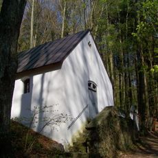
Wallfahrtskapelle Rastbuche in Grattersdorf
1.8 km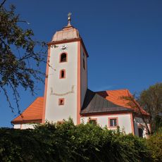
St. Johannes und St. Paulus
974 m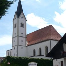
St. Ägidius
985 m
Kapelle
838 m
Kapelle
831 m
Kapelle
1.6 km
Cultural heritage D-2-7244-0152 in Grattersdorf
977 m
Ehemaliges Wohnstallhaus
1.8 km
Cultural heritage D-2-7144-0063 in Grattersdorf
986 m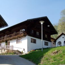
Grattersdorf Falkenacker 3
739 m
Getreidekasten Falkenacker 3 in Grattersdorf
722 m
Ehemaliges Wohnstallhaus
836 m
Wohnteil eines ehemaligen Einfirsthofs
1.1 km
Cultural heritage D-2-7144-0064 in Grattersdorf
950 m
Backhaus Breitenacker; In Falkenacker in Grattersdorf
748 m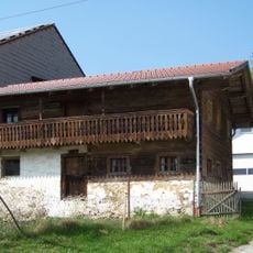
Ehemaliges Austragshaus
683 m
Totenbrett Konrading 4 in Grattersdorf
837 m
Totenbrett Büchelstein 39; Büchelstein 34; Nähe Büchelstein in Grattersdorf
1.8 km
Stall Lanzing 1 in Grattersdorf
1.6 km
Bauernhaus eines Vierseithofes
1.6 km
Memorial, war memorial
989 m
Catholic church building, wayside cross, Christianity
1.2 km
Wayside shrine
1.3 km
Catholic church building, wayside cross, Christianity
604 m
Helmbrecht
742 m
"steinernes Kreuz"
758 m
Wayside cross
377 m
Wayside cross
696 mReviews
Visited this place? Tap the stars to rate it and share your experience / photos with the community! Try now! You can cancel it anytime.
Discover hidden gems everywhere you go!
From secret cafés to breathtaking viewpoints, skip the crowded tourist spots and find places that match your style. Our app makes it easy with voice search, smart filtering, route optimization, and insider tips from travelers worldwide. Download now for the complete mobile experience.

A unique approach to discovering new places❞
— Le Figaro
All the places worth exploring❞
— France Info
A tailor-made excursion in just a few clicks❞
— 20 Minutes