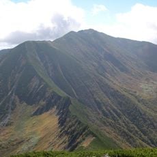
Mount Kumami, mountain in Hokkaido, Japan
Location: Hidaka Subprefecture
Elevation above the sea: 1,175 m
GPS coordinates: 42.98819,142.76372
Latest update: October 25, 2025 14:40
Mount Poroshiri
30.6 km
Chapel on the Water
14.3 km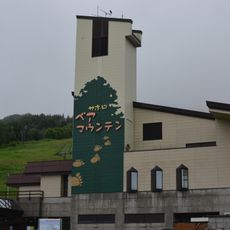
Sahoro Resort Bear Mountain
21.4 km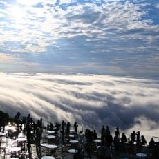
Unkai Terrace
16.7 km
Obihiro Sports Park
32.7 km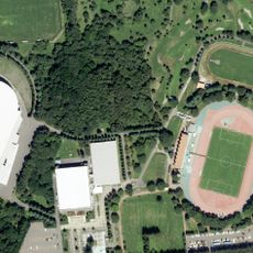
Obihiro Stadium
32.8 km
Heigen Ohashi Bridge
32.7 km
Suzuran Ohashi Bridge (Tokachi River)
34.7 km
Hidaka Mountains Museum
29 km
Sahoro Resort
20.2 km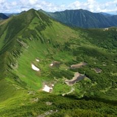
Mount Tottabetsu
28.3 km
Horse Museum
35.1 km
ぽっぽやロケ地
24.9 km
セイコーマート
29 km
狩勝高原エコトロッコ鉄道
19.4 km
十勝千年の森
10.5 km
登山口入り口
25.2 km
Flower iris garden
24 km
10線防風林
26.3 km
白樺並木道
33.9 km
石を拾う
29.1 km
Scenic viewpoint
16.5 km
狩勝峠展望台
16.4 km
金山ダム展望台
30.5 km
新嵐山スカイパーク展望台
25.1 km
清水円山展望台
11.5 km
十勝牧場展望台
31.6 km
日勝園地展望台
2.1 kmReviews
Visited this place? Tap the stars to rate it and share your experience / photos with the community! Try now! You can cancel it anytime.
Discover hidden gems everywhere you go!
From secret cafés to breathtaking viewpoints, skip the crowded tourist spots and find places that match your style. Our app makes it easy with voice search, smart filtering, route optimization, and insider tips from travelers worldwide. Download now for the complete mobile experience.

A unique approach to discovering new places❞
— Le Figaro
All the places worth exploring❞
— France Info
A tailor-made excursion in just a few clicks❞
— 20 Minutes