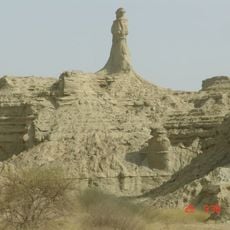
Harānrāi, cliff in Balochistan, Pakistan
Location: Balochistan
Elevation above the sea: 200 m
GPS coordinates: 25.34860,64.94830
Latest update: October 27, 2025 10:12
Hingol National Park
77.4 km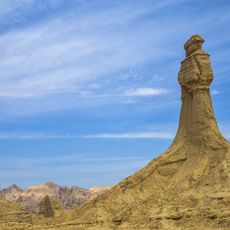
Princess of Hope
38.9 km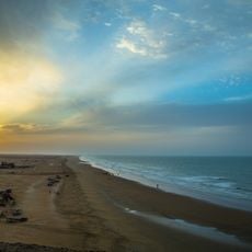
Kund Malir Beach
52.4 km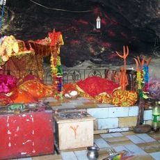
Hinglaj Mata
59.9 km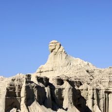
Balochistan Sphinx
36.8 km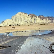
Hingol mud volcano
92.9 km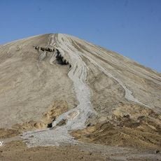
Chandragup
92.9 km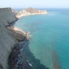
Astola Island Lighthouse
115.2 km
Kishti
163.1 km
Kund Malir Beach View Point by Kashif On Bike
51.4 km
Pasni Juddi Beach by Kashif On Bike
145.9 km
Mud Volcano
28.2 km
Mud Volcanoes
24.5 km
Pasni Rock Hill by Kashif On Bike
150.9 km
Sangal - Biggest Crater
82.5 km
Ormara Beach by Kashif On Bike
38.2 km
River into Sea View Point by Kashif On Bike
123.2 km
Mastani Desert Pasni by Kashif On Bike
149.3 km
Talkar Koh
32.2 km
Nani Mandir by Kashif On Bike
60.1 km
Princess of Hope
36.6 km
Kund Malir Beach
51.7 km
Welcome to Deoy
61.3 km
RANI
128.7 km
Scenic viewpoint
43.8 km
The famous viewpoint
43 km
Buzi Pass
31.9 km
Scenic viewpoint
92.9 kmReviews
Visited this place? Tap the stars to rate it and share your experience / photos with the community! Try now! You can cancel it anytime.
Discover hidden gems everywhere you go!
From secret cafés to breathtaking viewpoints, skip the crowded tourist spots and find places that match your style. Our app makes it easy with voice search, smart filtering, route optimization, and insider tips from travelers worldwide. Download now for the complete mobile experience.

A unique approach to discovering new places❞
— Le Figaro
All the places worth exploring❞
— France Info
A tailor-made excursion in just a few clicks❞
— 20 Minutes