
Kapelle, building in Neukirchen beim Heiligen Blut, Upper Palatinate, Germany
Location: Neukirchen beim Heiligen Blut
Address: Rötelfeld
GPS coordinates: 49.28577,13.01686
Latest update: November 24, 2023 23:44
Filialkirche Hl. Familie
1.6 km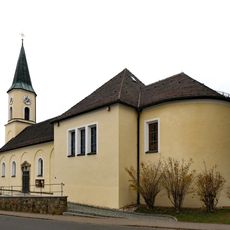
Herz Jesu (Warzenried)
3.5 km
Feldkapelle
2.7 km
Kapelle
3.6 km
Zugehöriger Wohnteil eines Bauernhauses
3.6 km
Cultural heritage D-3-6744-0004 in Eschlkam
1.1 km
Cultural heritage D-3-6744-0003 in Eschlkam
1.4 km
Hradiště Hradčany
3.6 km
Innerer Hahnen-Berg
3.4 km
Cultural heritage D-3-6643-0015 in Eschlkam
3.2 km
Cultural heritage D-3-6743-0124 in Eschlkam
1.8 km
Cultural heritage D-3-6744-0002 in Eschlkam
1.6 km
Cultural heritage D-3-6744-0012 in Neukirchen beim Heiligen Blut
630 m
Totenbretterreihe
3.7 km
Bauernhaus
3.3 km
Cultural heritage D-3-6643-0044 in Eschlkam
2.6 km
Cultural heritage D-3-6743-0015 in Eschlkam
2 km
Waldlerhaus des Schulerhofes
126 m
Cultural heritage D-3-6744-0021 in Neukirchen beim Heiligen Blut
3 km
Bauernhaus
1.7 km
Marter Jägershof 9 in Neukirchen beim Heiligen Blut
1.7 km
Memorial
2.1 km
Wayside cross
3.3 km
Hüttenkreuz-Kühnischer Freibauern 1400
3.3 km
Schmugglerdenkmal
2.8 km
Bývalý kostel v Červeném dřevě
2.2 km
Neuern im Bohmerwald
689 m
Wayside cross
688 mReviews
Visited this place? Tap the stars to rate it and share your experience / photos with the community! Try now! You can cancel it anytime.
Discover hidden gems everywhere you go!
From secret cafés to breathtaking viewpoints, skip the crowded tourist spots and find places that match your style. Our app makes it easy with voice search, smart filtering, route optimization, and insider tips from travelers worldwide. Download now for the complete mobile experience.

A unique approach to discovering new places❞
— Le Figaro
All the places worth exploring❞
— France Info
A tailor-made excursion in just a few clicks❞
— 20 Minutes