Schloßberg bei Hofeld, protected area in Germany
Location: Namborn
Inception: 1937
GPS coordinates: 49.51200,7.15150
Latest update: November 26, 2025 12:28
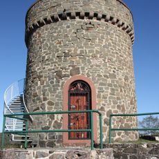
Ruine Liebenburg
95 m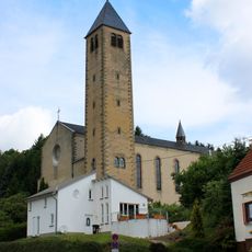
St. Willibrord
1.7 km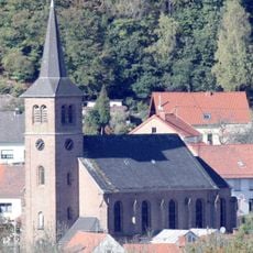
Mariä Himmelfahrt
1.3 km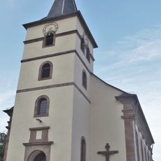
St. Anna
2 km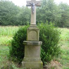
Reitscheider Kreuz
2.5 km
Landschaftsschutzgebiet im Landkreis St. Wendel - in der Stadt St. Wendel
1.6 km
Landschaftsschutzgebiet "Grauer Dorn bei Baltersweiler" (L 6508-304)
1.7 km
Landschaftsschutzgebiet im Landkreis St. Wendel - in der Gemeinde Oberthal
2.3 km
Grauer Dorn bei Baltersweiler
1.8 km
Landschaftsschutzgebiet im Landkreis St. Wendel - in der Gemeinde Namborn
1.2 km
Weiherbruch und Rohrbachwiesen
1.9 km
Landschaftsschutzgebiet im Landkreis St. Wendel - in der Gemeinde Namborn
2.3 km
Familie
1.9 km
Wayside cross
1.5 km
Rahmen für eine Landschaft
1.7 km
Wolkenstein
2.1 km
Scenic viewpoint
2.4 km
Wayside cross
401 m
Wayside cross
429 m
Reveil – Erwachen
1.6 km
Wayside cross
2 km
Wayside cross
1.2 km
Wayside cross
480 m
Wayside cross
1.9 km
Wayside cross
2 km
Memorial
2.1 km
Allerburg
720 m
Weir
769 mReviews
Visited this place? Tap the stars to rate it and share your experience / photos with the community! Try now! You can cancel it anytime.
Discover hidden gems everywhere you go!
From secret cafés to breathtaking viewpoints, skip the crowded tourist spots and find places that match your style. Our app makes it easy with voice search, smart filtering, route optimization, and insider tips from travelers worldwide. Download now for the complete mobile experience.

A unique approach to discovering new places❞
— Le Figaro
All the places worth exploring❞
— France Info
A tailor-made excursion in just a few clicks❞
— 20 Minutes