
Bildstock, 2. Hälfte 16. Jahrhundert; neben der Wegkapelle
Location: Obernzell
Address: im Ort
GPS coordinates: 48.56604,13.62399
Latest update: November 14, 2025 18:11
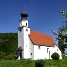
Kath. Filialkirche hll. Peter und Paul
1.3 km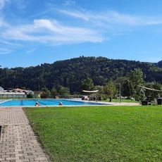
Freibad Obernzell
895 m
Ehemalige Pfarrkirche
1.4 km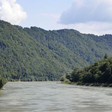
Donauengtal Erlau-Jochenstein
267 m
Weilerkapelle
443 m
Wegkapelle
1.2 km
Kreuzsäulenkapelle
764 m
Cultural heritage D-2-7447-0046 in Obernzell
1.4 km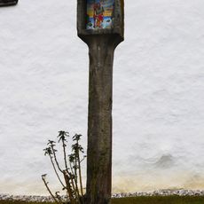
Bildstock
1.3 km
Ehem. Schmelztiegelfabrik Saxinger
1.2 km
Ehemaliger Pfarrhof
1.4 km
Bahnhofsgebäude
1.1 km
Erdgeschossiges Waldlerhaus
1.1 km
Heiligenhäuschen
1.1 km
Warteraum Bahnhofstraße 4 in Obernzell
1.1 km
Nebengebäude der Graphitmühle
1.2 km
Kapelle
994 m
"Hammermühle"
1.1 km
Kühweide
17 m
Bauernhaus
404 m
Wegkreuz
1.3 km
Nebengebäude Klosterweg 31 in Obernzell
1.4 km
Kreuz Nähe Eckerstampf in Obernzell
1 km
Panoramablick Pyrawang
1.4 km
Scenic viewpoint
701 m
Scenic viewpoint
978 m
Christianity, wayside shrine
1.1 km
Wayside cross
1.2 kmReviews
Visited this place? Tap the stars to rate it and share your experience / photos with the community! Try now! You can cancel it anytime.
Discover hidden gems everywhere you go!
From secret cafés to breathtaking viewpoints, skip the crowded tourist spots and find places that match your style. Our app makes it easy with voice search, smart filtering, route optimization, and insider tips from travelers worldwide. Download now for the complete mobile experience.

A unique approach to discovering new places❞
— Le Figaro
All the places worth exploring❞
— France Info
A tailor-made excursion in just a few clicks❞
— 20 Minutes