
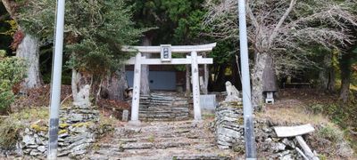
鉾神社, Shinto shrine in Japan
Location: Miyoshi
Address: 徳島県三好市東祖谷大枝45 778-0204 778-0204
GPS coordinates: 33.87871,133.88413
Latest update: November 12, 2025 23:35
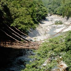
Kazura bridge at the Iya Valley
4.5 km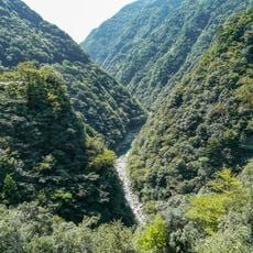
Iya Valley
4.5 km
Kurishido hachiman-jinja
3.4 km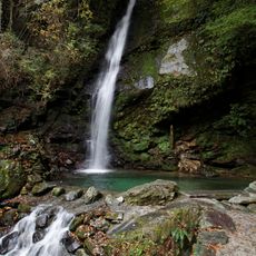
Biwa Falls
4.4 km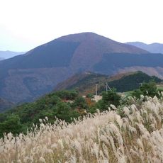
Mount Nakatsu
6.3 km
安楽寺
9 km
秘境祖谷大橋
5 km
Mount Nishikuma
8.8 km
Ochiai viewpoint
4.5 km
Ochiai-toge Overlook
7.5 km
Ochiai Village
4.7 km
Iya Roman Bridge
6.6 km
祖谷溪 U字形溪谷
7 km
Iya Valley Manneken-Pis
7.9 km
京柱茶屋
6.4 km
Ochiai Mountain Pass (Ochiai-toge)
7.3 km
Ochi-hage
6.4 km
Iya Valley
7.2 km
Manpu Gorge
2 km
京柱峠
6.4 km
Hi-no-Ji Bend Viewpoint
6.9 km
Scenic viewpoint
1.6 km
Scenic viewpoint
7.3 km
装束石
5.7 km
かずら橋イベント広場竣工記念碑
4.7 km
蔓橋 地蔵尊
4.5 km
びわの滝
4.4 km
Waterfall
7.3 kmReviews
Visited this place? Tap the stars to rate it and share your experience / photos with the community! Try now! You can cancel it anytime.
Discover hidden gems everywhere you go!
From secret cafés to breathtaking viewpoints, skip the crowded tourist spots and find places that match your style. Our app makes it easy with voice search, smart filtering, route optimization, and insider tips from travelers worldwide. Download now for the complete mobile experience.

A unique approach to discovering new places❞
— Le Figaro
All the places worth exploring❞
— France Info
A tailor-made excursion in just a few clicks❞
— 20 Minutes