Øynad'n, protected area in Norway (Naturbase code: VV00001398)
Location: Vestre Slidre Municipality
Location: Vang
Inception: October 12, 1990
GPS coordinates: 60.95610,8.66890
Latest update: June 13, 2024 14:40
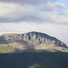
Skogshorn
8.4 km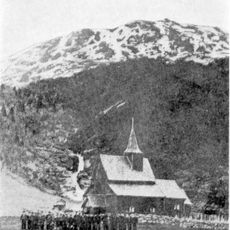
Hemsedal Stave Church
11.6 km
Helin plantepark
12.4 km
Hemsedal Church
12 km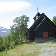
Lykkja kapell
12.3 km
Hydalen
6.1 km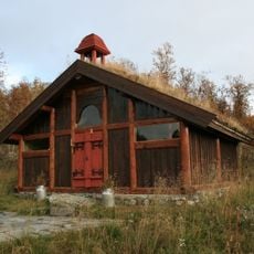
Harahorn chapel
11.9 km
Krigshamrane
8.9 km
Grønsennknipa
10 km
Smådaladn
9.8 km
Kyrkja
9 km
Kvannegrønosi
5 km
Hovda
10 km
Rosshamrane
10.9 km
Jørundgilknappen
5.4 km
Markegårdslia
9.9 km
Https://photos.app.goo.gl/n9auuAtdQK8RRA6D7
11.6 km
Scenic viewpoint
11.5 km
Scenic viewpoint
9.9 km
Scenic viewpoint
10 km
Scenic viewpoint
11.6 km
Scenic viewpoint
9.7 km
Scenic viewpoint
5.7 km
Høyt & Lavt Hemsedal
12.1 km
Work of art, graffiti
12.2 km
Hemsedal beach
12.2 km
Scenic viewpoint
11.1 km
Scenic viewpoint
12.3 kmReviews
Visited this place? Tap the stars to rate it and share your experience / photos with the community! Try now! You can cancel it anytime.
Discover hidden gems everywhere you go!
From secret cafés to breathtaking viewpoints, skip the crowded tourist spots and find places that match your style. Our app makes it easy with voice search, smart filtering, route optimization, and insider tips from travelers worldwide. Download now for the complete mobile experience.

A unique approach to discovering new places❞
— Le Figaro
All the places worth exploring❞
— France Info
A tailor-made excursion in just a few clicks❞
— 20 Minutes