Nøtterøy golfbane
Location: Færder Municipality
GPS coordinates: 59.22266,10.39384
Latest update: November 16, 2025 18:52
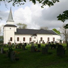
Nøtterøy Church
1.1 km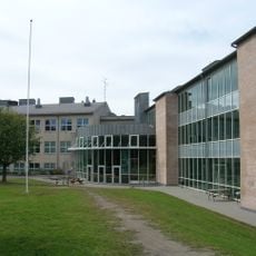
Borgheim ungdomsskole
731 m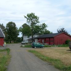
Nøtterøy prestegård
1.2 km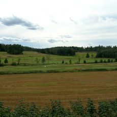
Nøtterøy golfbane
403 m
Nøtterøy vestre
878 m
Nøtterøy golfbane
285 m
Sande nordre
725 m
Hella
812 m
Nøtterøy golfbane
175 m
Nøtterøy vestre 2
936 m
Hella
1.2 km
Nøtterøy golfbane
251 m
Nøtterøy
1.1 km
Nøtterøy golfbane
575 m
Nøtterøy golfbane
630 m
Nøtterøy golfbane
510 m
Nøtterøy golfbane
551 m
Nøtterøy Golfbane
553 m
Sande nordre
267 m
Engstykket kalles Røysa.
311 m
Sande nordre
239 m
Nøtterøy golfklubb
393 m
Hellaskogen
844 m
Brødrene Hanssens auto
798 m
Nøtterøy kulturhus
937 m
Nøtterøy kulturhus
938 m
Hellastranda
905 m
Sculpture, Work of art
911 mReviews
Visited this place? Tap the stars to rate it and share your experience / photos with the community! Try now! You can cancel it anytime.
Discover hidden gems everywhere you go!
From secret cafés to breathtaking viewpoints, skip the crowded tourist spots and find places that match your style. Our app makes it easy with voice search, smart filtering, route optimization, and insider tips from travelers worldwide. Download now for the complete mobile experience.

A unique approach to discovering new places❞
— Le Figaro
All the places worth exploring❞
— France Info
A tailor-made excursion in just a few clicks❞
— 20 Minutes