Glattrevannet, dam in Kristiansand, Noorwegen
Location: Kristiansand Municipality
GPS coordinates: 58.20989,7.95129
Latest update: November 14, 2025 15:27
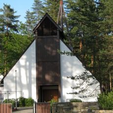
Torridal Church
1.4 km
Skråstadheia
1.8 km
Ia
1.9 km
Engvanningsmyr V
2 km
Engvanningsmyr Ø
1.9 km
Mølledammen i Auglandsdalen
2.2 km
Glattre kvern
1.1 km
Glattre sag
1.1 km
Augland i Torridal
1.5 km
Augland mølle
2.1 km
Skråstads øydgard
1.9 km
Åsnestøl
1.6 km
Glattredalen
165 m
Augland sav
1.7 km
Grostøl
2.1 km
Lille Røyåsen
1.7 km
Meåsen
2 km
Krogvannsheia
1.4 km
Buhagen
596 m
Lians øydgard
1.3 km
Svinekjerr
1.4 km
Bjønnehiet
2 km
Lona
1.6 km
Hagane
905 m
Byttingstjønn
606 m
Glattredalen
373 m
Sagevannet
1.5 km
Butjønn
2.1 kmReviews
Visited this place? Tap the stars to rate it and share your experience / photos with the community! Try now! You can cancel it anytime.
Discover hidden gems everywhere you go!
From secret cafés to breathtaking viewpoints, skip the crowded tourist spots and find places that match your style. Our app makes it easy with voice search, smart filtering, route optimization, and insider tips from travelers worldwide. Download now for the complete mobile experience.

A unique approach to discovering new places❞
— Le Figaro
All the places worth exploring❞
— France Info
A tailor-made excursion in just a few clicks❞
— 20 Minutes