
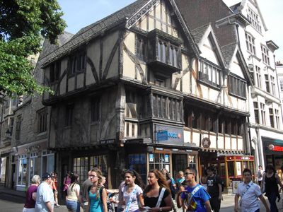
26 And 27, Cornmarket Street, building in Oxford, Oxfordshire, UK
Location: Oxford
Address: 26 And 27, Cornmarket Street, Oxford, Oxfordshire, OX1
GPS coordinates: 51.75346,-1.25843
Latest update: March 3, 2025 00:15

St Michael at the North Gate
18 m
Northgate Hall
77 m
City Church
29 m
39, Cornmarket Street
24 m
Oxford Union Society Old Library
88 m
12, Ship Street
87 m
6, Ship Street
67 m
41 And 42, Cornmarket Street
22 m
8, St Michaels Street
49 m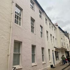
3, Ship Street
51 m
12, Broad Street
95 m
11, Broad Street
92 m
Oxford Union Society Main Block
71 m
40, Cornmarket Street
22 m
Jesus College, New Block On The South Side Of Ship Street
64 m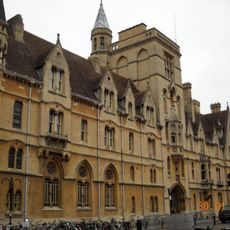
Balliol College, Fisher Buildings, Garden Quarangle
98 m
10, Ship Street
78 m
9, Ship Street
75 m
Wall of the Oxford Union Society Fronting St Michaels Street
81 m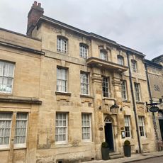
Vanburgh House
93 m
10, St Michaels Street
55 m
6, Broad Street
82 m
1 and 2, Ship Street
40 m
4, Ship Street
57 m
7 And 8, Broad Street
86 m
13, Broad Street
99 m
26, Ship Street
8 m
Jesus College, South Range, Inner Quadrangle
95 mReviews
Visited this place? Tap the stars to rate it and share your experience / photos with the community! Try now! You can cancel it anytime.
Discover hidden gems everywhere you go!
From secret cafés to breathtaking viewpoints, skip the crowded tourist spots and find places that match your style. Our app makes it easy with voice search, smart filtering, route optimization, and insider tips from travelers worldwide. Download now for the complete mobile experience.

A unique approach to discovering new places❞
— Le Figaro
All the places worth exploring❞
— France Info
A tailor-made excursion in just a few clicks❞
— 20 Minutes