
Field Shelter About 200 Metres South-West Of Ramshaw Hall
Field Shelter About 200 Metres South-West Of Ramshaw Hall, architectural structure in Evenwood and Barony, County Durham, UK
Location: Evenwood and Barony
GPS coordinates: 54.63307,-1.76415
Latest update: November 14, 2025 05:51
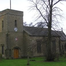
Church of St Cuthbert
2.2 km
The Eden Arms Public House
2.5 km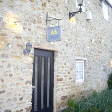
The Old Manor House Hotel
2.6 km
County Bridge Marker In Recess In Outhouse To No 1
1.9 km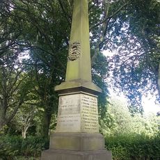
Evenwood War Memorial
854 m
Engine Pond
2.6 km
County Council Marker Stone In Front Of No. 13
2 km
Front Garden Wall At The Old Manor House Hotel
2.6 km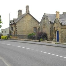
Former Parish School And Wall Attached
2.3 km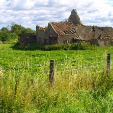
Farm Buildings C.200 Metres North-West Of Green Field Farm
2.3 km
Shelter Shed At Manor Stables
2.5 km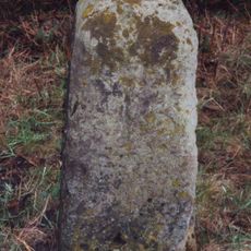
Milestone C.100 Metres North-East Of New Moor Lodge
2.3 km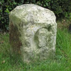
County Council Marker Stone In Front Of No. 77
2.6 km
Toft Hill Hall
2.3 km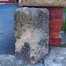
Toft Hill
1.7 km
High Etherley
2 km
Mounting Block South Of Entrance To Toft Hill Hall
2.2 km
Number 2A And Manor Stables
2.5 km
Erw Wen And Attached Garden Walls
2.5 km
East Range To Rear Of The Old Manor House Hotel
2.6 km
Evenwood Bridge
777 m
4 And 6, Staindrop Road
2.5 km
Wall And Piers Enclosing Garden In Front Of Toft Hill Hall
2.2 km
Ramshaw Hall
33 m
High Etherley War Memorial
2.2 km
Houghton House
2.1 km
The Rectory
2.2 km
Work of art, sculpture
2.5 kmReviews
Visited this place? Tap the stars to rate it and share your experience / photos with the community! Try now! You can cancel it anytime.
Discover hidden gems everywhere you go!
From secret cafés to breathtaking viewpoints, skip the crowded tourist spots and find places that match your style. Our app makes it easy with voice search, smart filtering, route optimization, and insider tips from travelers worldwide. Download now for the complete mobile experience.

A unique approach to discovering new places❞
— Le Figaro
All the places worth exploring❞
— France Info
A tailor-made excursion in just a few clicks❞
— 20 Minutes