
Infant School Village Hall, architectural structure in Blunsdon St. Andrew, Swindon, Wiltshire, UK
Location: Blunsdon St Andrew
GPS coordinates: 51.61433,-1.78200
Latest update: November 25, 2023 00:32
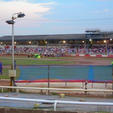
Swindon Stadium
1 km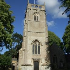
Church of St Leonard
158 m
The Cottage
333 m
Fowler's Farm Cottage
749 m
Well Head North East Of Upper Burytown Farmhouse
924 m
Castle Hill, Blunsdon St Andrew
742 m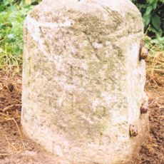
Milestone To West Of Dinton
510 m
Tomb Of Robert Litton In St Leonard's Churchyard
181 m
16 And 18, High Street
24 m
2 And 3, Holdcroft Lane
238 m
The Retreat
312 m
The Old School
921 m
Deacon's Court
351 m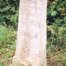
Milestone On B4019
1.3 km
Upper Burytown Farmhouse
901 m
Milestone
1.4 km
Large's House
885 m
Manor House
108 m
66, High Street
357 m
The Rectory
228 m
Churchyard Cross
152 m
Milestone Near Number 8 Hyde Road
850 m
Fowler's Farmhouse
733 m
St Leonard's Farmhouse
898 m
Broad Blunsdon War Memorial Cross
375 m
47, High Street
346 m
West Hill House
293 m
King Tomb In St Leonard's Churchyard
161 mReviews
Visited this place? Tap the stars to rate it and share your experience / photos with the community! Try now! You can cancel it anytime.
Discover hidden gems everywhere you go!
From secret cafés to breathtaking viewpoints, skip the crowded tourist spots and find places that match your style. Our app makes it easy with voice search, smart filtering, route optimization, and insider tips from travelers worldwide. Download now for the complete mobile experience.

A unique approach to discovering new places❞
— Le Figaro
All the places worth exploring❞
— France Info
A tailor-made excursion in just a few clicks❞
— 20 Minutes