Park Cottage, cottage in Reigate and Banstead, Surrey, UK
Location: Reigate and Banstead
GPS coordinates: 51.32186,-0.19344
Latest update: November 21, 2025 10:29
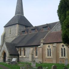
Church of All Saints
510 m
Circular Outbuilding 20 Yards South East Of Park Farm Stable Block
1.5 km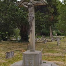
War Memorial, Church of All Saints, Banstead
530 m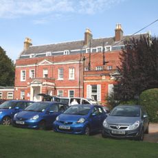
Banstead Place
491 m
Woodmans Cottage
10 m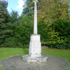
Banstead War Memorial
327 m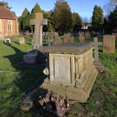
Chest Tomb 40 Yards South Of Church Of All Saints
512 m
Park Farm Cottage
1.4 km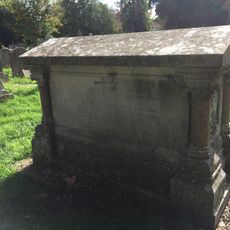
Muggeridge Tomb 20 Yards West Of Church Of All Saints
538 m
Rosehill
144 m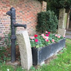
Horse Trough With Pump At Entrance To No 19 (Little Garratts)
926 m
Two Saxon burial mounds on Gally Hills, west of Brighton Road
1.5 km
Two Saxon burial mounds on Gally Hills
1.5 km
Queen Elizabeth Hospital (Comprising Main Block And Attached Former Nurses Home And Former Wards)
1.6 km
Bowl barrow and later beacon at Tumble Beacon
1.8 km
Little Garratts
907 m
Soloms Court And Little Soloms
1.4 km
Weston Acres, Including Terrace Wall
1.3 km
Lodge To Queen Elizabeth Hospital
1.1 km
Circular Outbuilding 40 Yards North West Of Park Farm Stable Block
1.4 km
Mint Farm House
523 m
Stable Block 50 Yards South Of Park Farm Cottage
1.5 km
War Memorial Lych Gate to the Church of St Peter, Woodmansterne
1.7 km
Wilmot
22 m
Wellhead At The Junction With Woodmansterne Lane
255 m
Banstead Downs Golf Club
1.7 km
Wardrobe (Narnia Trail)
1.7 km
White Witch (Narnia Trail)
1.7 kmReviews
Visited this place? Tap the stars to rate it and share your experience / photos with the community! Try now! You can cancel it anytime.
Discover hidden gems everywhere you go!
From secret cafés to breathtaking viewpoints, skip the crowded tourist spots and find places that match your style. Our app makes it easy with voice search, smart filtering, route optimization, and insider tips from travelers worldwide. Download now for the complete mobile experience.

A unique approach to discovering new places❞
— Le Figaro
All the places worth exploring❞
— France Info
A tailor-made excursion in just a few clicks❞
— 20 Minutes