128, Kings Road, building in The City of Brighton and Hove, West Sussex, UK
Location: Brighton and Hove
GPS coordinates: 50.82182,-0.14993
Latest update: November 21, 2025 10:52
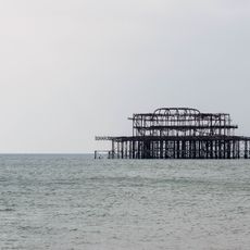
West Pier
138 m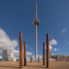
Brighton i360
138 m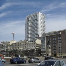
Sussex Heights
109 m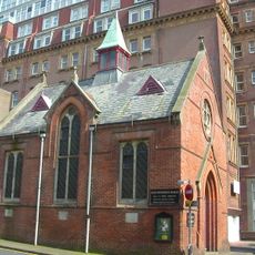
French Protestant Church, Brighton
36 m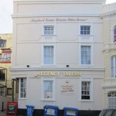
The Regency Tavern
146 m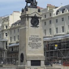
Royal Sussex Regt Boer War Memorial
55 m
Shelter Opposite The Metropole Hotel
109 m
2, 3 and 4, Regency Square
98 m
Shelter Facing The End Of Preston Street
119 m
Numbers 5-20 And Attached Railings
123 m
The Golden Spiral
78 m
Numbers 60-66 And Attached Railings
53 m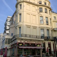
131, Kings Road
96 m
Numbers 57 And 58 And 59 And Attached Railings
76 m
5, Preston Street
144 m
Numbers 51-56 And Attached Railings
110 m
Numbers 47 And 48 And 49 And Attached Railings
129 m
46A, Regency Square
152 m
46B, Regency Square
137 m
Numbers 125 And 126 And Attached Railings
13 m
31 And 32, Cannon Place
158 m
Numbers 38-46 Including Carriage Arch And Attached Railings
149 m
Two Bollards In The Passage Next To The Regency Tavern
149 m
35, Russell Square
147 m
Numbers 36-45 And Attached Railings
158 m
Number 79 And Attached Railings
139 m
Rampion Offshore Wind Farm Visitor Centre
54 m
Upside Down House ticket office
158 mReviews
Visited this place? Tap the stars to rate it and share your experience / photos with the community! Try now! You can cancel it anytime.
Discover hidden gems everywhere you go!
From secret cafés to breathtaking viewpoints, skip the crowded tourist spots and find places that match your style. Our app makes it easy with voice search, smart filtering, route optimization, and insider tips from travelers worldwide. Download now for the complete mobile experience.

A unique approach to discovering new places❞
— Le Figaro
All the places worth exploring❞
— France Info
A tailor-made excursion in just a few clicks❞
— 20 Minutes