662, High Road N17, building in Haringey, Greater London, UK
Location: London Borough of Haringey
GPS coordinates: 51.59953,-0.06765
Latest update: November 14, 2025 21:30
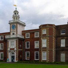
Bruce Castle
529 m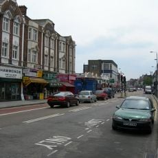
Tottenham High Road
131 m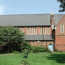
Church of St Mary the Virgin
132 m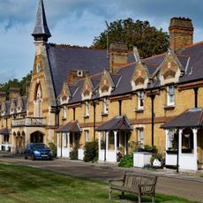
Chapel At Drapers' Almshouses The Drapers' Almshouses
439 m
South Boundary Wall To Bruce Castle Park
443 m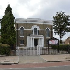
Tottenham Baptist Church
207 m
Fronting To Chapel Stores
216 m
Fronting To Church Road
299 m
15A, Bruce Grove N17
534 m
Lodge To South East Of Draper's Almshouses
460 m
Southern Gate Building At Whitbread's Brewery
59 m
Charlton Cottage
385 m
Walls In Front Of Numbers 583 And 585
358 m
664 And 666, High Road N17
8 m
8-18, Lordship Lane N17
172 m
668 And 668A, High Road N17
19 m
15 And 16, Bruce Grove N17
529 m
Wall To North Of Garden Of Number 16 Fronting The Avenue
525 m
639, High Road N17
74 m
670, High Road N17
58 m
583 And 585, High Road N17
372 m
2, King's Road N17
250 m
774, High Road N17
520 m
Walls Along South Boundary Of Number 581 And Around Back Gardens Of Numbers 581, 583 And 585
390 m
695 And 697, High Road N17
173 m
Tottenham Magistrates Court
407 m
Hotspur Cinema
326 m
Studios 5, 6, 7, 8
530 mReviews
Visited this place? Tap the stars to rate it and share your experience / photos with the community! Try now! You can cancel it anytime.
Discover hidden gems everywhere you go!
From secret cafés to breathtaking viewpoints, skip the crowded tourist spots and find places that match your style. Our app makes it easy with voice search, smart filtering, route optimization, and insider tips from travelers worldwide. Download now for the complete mobile experience.

A unique approach to discovering new places❞
— Le Figaro
All the places worth exploring❞
— France Info
A tailor-made excursion in just a few clicks❞
— 20 Minutes