Ratuokliškio tvenkinys, reservoir in Lithuania
Location: Rokiškis District Municipality
GPS coordinates: 55.88056,25.85944
Latest update: November 16, 2025 02:26

Aleksandravėlė
5.2 km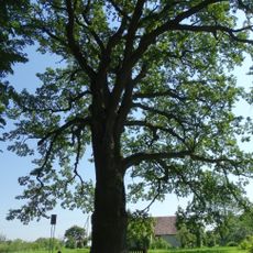
Bradesių ąžuolas
5.6 km
Church of St. Anne, Obeliai
7.7 km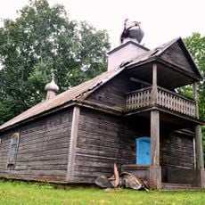
Old Believers Church in Bobriškis
6.2 km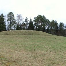
Velikuškių I piliakalnis
5.3 km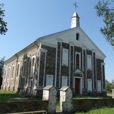
Church of the Providence of God in Kriaunos
5.2 km
Velikuškės 2nd hillfort
6 km
Pakačinės hillfort
7.6 km
Bradesių piliakalnis
4.9 km
Church of St. Francis Seraph, Aleksandravėlė
5.1 km
Maniuliškių piliakalnis
8.4 km
Kalnočių piliakalnis
2.2 km
Pakriaunio akmuo
4.3 km
Mielėnai hillfort
3.4 km
Papilių piliakalnis (Rokiškis)
7.8 km
Góra zamkowa Dirdy
6.5 km
Junkūnų piliakalnis
4.9 km
Stasiūnų piliakalnis
5.8 km
Ivoniškių piliakalnis
8 km
Mingėlių tvenkinys
5.7 km
Apeikiškio tvenkinys
2.1 km
Obelių šilo mūšio vieta
4.4 km
Antazavės šilo mūšio vieta, partizanų žeminės
7.6 km
Work of art
8.1 km
Work of art
8.1 km
Work of art
8.1 km
Wieża widokowa nad Sartami
4.6 km
Bradesių ąžuolas
5.6 kmReviews
Visited this place? Tap the stars to rate it and share your experience / photos with the community! Try now! You can cancel it anytime.
Discover hidden gems everywhere you go!
From secret cafés to breathtaking viewpoints, skip the crowded tourist spots and find places that match your style. Our app makes it easy with voice search, smart filtering, route optimization, and insider tips from travelers worldwide. Download now for the complete mobile experience.

A unique approach to discovering new places❞
— Le Figaro
All the places worth exploring❞
— France Info
A tailor-made excursion in just a few clicks❞
— 20 Minutes