Lavoir
Location: Saint-Pierre-d'Albigny
GPS coordinates: 45.57850,6.17075
Latest update: November 15, 2025 10:09
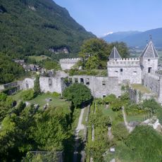
Fortress of Miolans
1.2 km
Château des Allues
2.4 km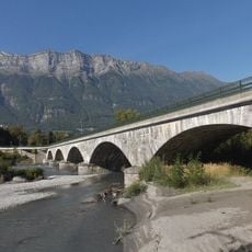
Pont Royal de Chamousset
2.8 km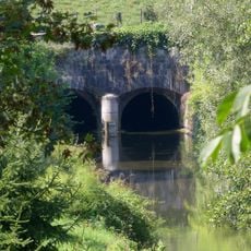
Tunnel hydraulique du Gelon
3.2 km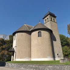
Église Saint-Maurice de Chamousset
3.2 km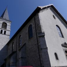
Église Saint-Pierre de Saint-Pierre-d'Albigny
1.7 km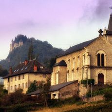
Église Saint-Christophe de Fréterive
2.6 km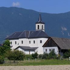
Église Saint-Étienne de Châteauneuf
3.3 km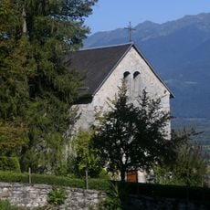
Chapelle castrale Saint-Michel de Miolans
1.3 km
Pierre Besse
2.5 km
Vue sur l'Arclusaz
2.5 km
Scenic viewpoint
3.6 km
La Barme
286 m
Memorial
2.9 km
Martinet de Lescheraines
2.3 km
Dent d'Arclusaz
2.5 km
Wayside cross
2.8 km
City gate
1.2 km
Wayside cross
2 km
Vue panoramique sur la combe de Savoie
1.2 km
Stele, memorial
2.5 km
Memorial
3 km
Croix de la Tronche
3.2 km
Wayside shrine
58 m
Wayside cross
1 km
Wayside cross
781 m
Wayside shrine, Christianity
2.1 km
Waterfall
3.4 kmReviews
Visited this place? Tap the stars to rate it and share your experience / photos with the community! Try now! You can cancel it anytime.
Discover hidden gems everywhere you go!
From secret cafés to breathtaking viewpoints, skip the crowded tourist spots and find places that match your style. Our app makes it easy with voice search, smart filtering, route optimization, and insider tips from travelers worldwide. Download now for the complete mobile experience.

A unique approach to discovering new places❞
— Le Figaro
All the places worth exploring❞
— France Info
A tailor-made excursion in just a few clicks❞
— 20 Minutes