Fountain
Location: Valleraugue
Location: Val-d'Aigoual
GPS coordinates: 44.06782,3.69193
Latest update: November 12, 2025 05:48

Memorial, drinking fountain
259 m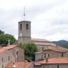
Église Saint-André de Saint-André-de-Majencoules
4.6 km
Serre de Borgne
3.3 km
Temple de Valleraugue
4.2 km
Truc de Montaigu
2.4 km
Scenic viewpoint
4.9 km
Belvédère des 4000 marches
4.3 km
Wayside cross
4.4 km
Wayside cross
4.8 km
Monument au maquis Aigoual-Cévennes
5.2 km
Catholic church building, wayside cross
4.3 km
Wayside cross
5.1 km
Memorial, war memorial
4.3 km
Wayside cross
2.2 km
Statue, Work of art
4.3 km
Wayside cross
4.6 km
Memorial, war memorial
4.2 km
Wayside cross
5 km
Menhir du Col de Bès
3.5 km
Wayside cross
4.7 km
Wayside shrine
4.4 km
Wayside cross
2.1 km
Jean Joseph Triaire
2 km
Wayside cross
5.1 km
Tomb
57 m
Tomb
57 m
Waterfall
2.6 km
Waterfall
5 kmReviews
Visited this place? Tap the stars to rate it and share your experience / photos with the community! Try now! You can cancel it anytime.
Discover hidden gems everywhere you go!
From secret cafés to breathtaking viewpoints, skip the crowded tourist spots and find places that match your style. Our app makes it easy with voice search, smart filtering, route optimization, and insider tips from travelers worldwide. Download now for the complete mobile experience.

A unique approach to discovering new places❞
— Le Figaro
All the places worth exploring❞
— France Info
A tailor-made excursion in just a few clicks❞
— 20 Minutes