Market and taxi station
Location: Asuogyaman District
GPS coordinates: 6.27534,0.05070
Latest update: October 26, 2025 13:25

Akosombo Dam
2.9 km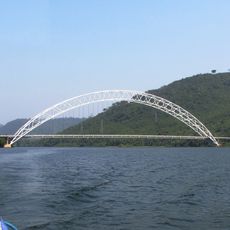
Adome Bridge
6.4 km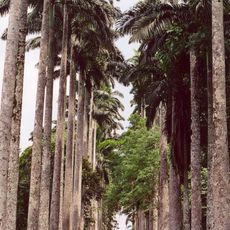
Aburi Botanical Gardens
52.4 km
Umbrella Rock
30.6 km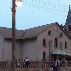
Christ Presbyterian Church, Akropong
37.1 km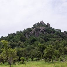
Shai Hills Resource Reserve
40.8 km
Fort Fredensborg
60.3 km
St. Barbara Catholic Church
2.7 km
Akaa Falls
29.5 km
Volta Regional Museum
59.3 km
Boti Falls
31 km
Department of Parks and Gardens
40.9 km
Okomfo Anokye’s Shrine
33.2 km
Eastern Regional Library, GhLA
40.4 km
Coffins Koluedor
60 km
Coffins Sege
56.7 km
Huhunya Waterfalls
28.3 km
Mount Krobo
21.7 km
Akaa Falls
29.5 km
Umbrella Rock
31.9 km
3 in 1 Palm Tree
31.9 km
Bunso Canopy walk
56.6 km
Sikorsky H-19
53.3 km
Arthurs place
46.7 km
Cedi Beads
16.5 km
Work of art, sculpture
53.2 km
Scenic viewpoint
41.8 km
Scenic viewpoint
29.4 kmVisited this place? Tap the stars to rate it and share your experience / photos with the community! Try now! You can cancel it anytime.
Discover hidden gems everywhere you go!
From secret cafés to breathtaking viewpoints, skip the crowded tourist spots and find places that match your style. Our app makes it easy with voice search, smart filtering, route optimization, and insider tips from travelers worldwide. Download now for the complete mobile experience.

A unique approach to discovering new places❞
— Le Figaro
All the places worth exploring❞
— France Info
A tailor-made excursion in just a few clicks❞
— 20 Minutes