Rope bridge
Location: Préfecture de Pita
GPS coordinates: 11.09542,-12.40579
Latest update: October 17, 2025 00:11

Télimélé
71.9 km
Stade Régional Saifoullaye Diallo
28.4 km
Kambadaga Falls
14.5 km
Forêt de Dalaba
49.1 km
Kouratier
47.8 km
Chute de Ditinn
39.3 km
Cascade de Tabouna
123.3 km
Villa de Dalaba
48.6 km
Case à palabres de Dalaba
48.6 km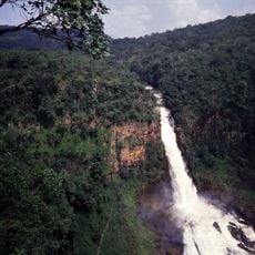
Chuttes de Sala
25.5 km
Kambadaga Falls View
14.9 km
Scenic viewpoint
70.7 km
Pont du dieu
50.2 km
Hollow tree
56.5 km
Centre d'Exposition et de Vente Touristique
48.3 km
Case Myriam Makeba
48.3 km
Scenic viewpoint
114.1 km
KOBA
106.8 km
Chutes de Dongora
27.9 km
Pont des Lianes
14.3 km
Scenic viewpoint
6.9 km
Scenic viewpoint
25.3 km
Scenic viewpoint
25.2 km
Scenic viewpoint
42.9 km
Scenic viewpoint
70.6 km
Vue sur Dalaba centre
47.9 km
Terrasse de l'hôtel du Fouta
47.8 km
Scenic viewpoint
114.4 kmReviews
Visited this place? Tap the stars to rate it and share your experience / photos with the community! Try now! You can cancel it anytime.
Discover hidden gems everywhere you go!
From secret cafés to breathtaking viewpoints, skip the crowded tourist spots and find places that match your style. Our app makes it easy with voice search, smart filtering, route optimization, and insider tips from travelers worldwide. Download now for the complete mobile experience.

A unique approach to discovering new places❞
— Le Figaro
All the places worth exploring❞
— France Info
A tailor-made excursion in just a few clicks❞
— 20 Minutes