Yemahuevo
Location: Bni Chiker ⴱⵏⵉ ⵛⵉⴽⵔ جماعة بني شيكر
GPS coordinates: 35.42008,-2.99655
Latest update: November 12, 2025 10:00
Fort of Rostrogordo
12.3 km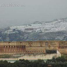
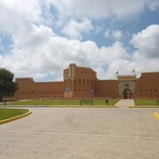
Fort Cabrerizas Altas
13.2 km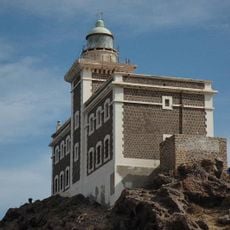
Cape Three Forks Lighthouse
3.6 km
Playa de Aguadú
12.7 km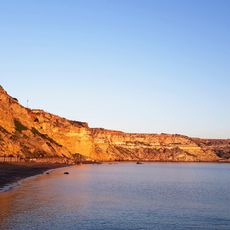
Horcas Coloradas
13.9 km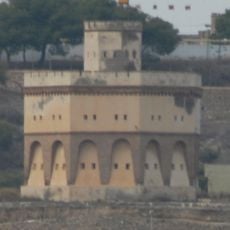
Fortín de Reina Regente, Melilla
14 km
Tibouda Beach
3.9 km
Tramontana Beach
2.5 km
Aguadú Cliffs
11.8 km
Cara Blanca
7.7 km
Playa del Quemado
12.1 km
Mezquita de Cabrerizas
14 km
Cala Bonita
4.4 km
Embarcadero
3.6 km
Charranes Beach
3.5 km
Cala Salmonete
4 km
Cala Cazón
4.2 km
Cala Cañaveral
1.8 km
Tramontana Beach
2.5 km
Playa de Horcas Coloradas
13.7 km
Playa de Charrana
3.1 km
Playa de Charrana
3.5 km
Scenic viewpoint
12.5 km
Summit, hill, scenic viewpoint, mountain
10.5 km
Scenic viewpoint
3 km
ⵡⴰⵔⴽ /ⵡⴰⵔⵛ/
1.6 km
Memorial
13.6 km
Playa Cala Blanca
6.9 kmReviews
Visited this place? Tap the stars to rate it and share your experience / photos with the community! Try now! You can cancel it anytime.
Discover hidden gems everywhere you go!
From secret cafés to breathtaking viewpoints, skip the crowded tourist spots and find places that match your style. Our app makes it easy with voice search, smart filtering, route optimization, and insider tips from travelers worldwide. Download now for the complete mobile experience.

A unique approach to discovering new places❞
— Le Figaro
All the places worth exploring❞
— France Info
A tailor-made excursion in just a few clicks❞
— 20 Minutes