Kerma period cemetery
Location: الولاية الشمالية
GPS coordinates: 20.70272,30.32927
Latest update: November 14, 2025 21:05
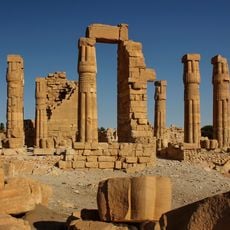
Soleb
30 km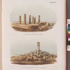
Sedeinga
35.4 km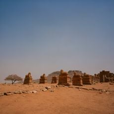
Sesebi
69.7 km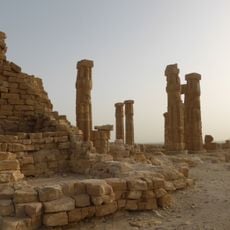
Temple of Soleb
29.7 km
Jebel Dosha
22.8 km
Church at Sai Island
4.8 km
نزله عكاشه لامطرق
75.8 km
قبة الخليفة الشيخ إدريس على الرضا
2 km
Medieval Church ruins
4.8 km
Sai New Kingdom city
3.8 km
سوق و طواحين عكاشه
58.3 km
خط ام طرق زول جنابو احمد
80.8 km
ذهب
82.2 km
دهب 1
82.3 km
Jebel Dosha
24.7 km
Temple de Tiyi
17.1 km
Temple d'Amon
29.7 km
Camel Bones
59.3 km
Beautiful view on the Nile and palm trees
21.3 km
Sesibi
69.6 km
Gravure de Djebel Docha
24.8 km
Sedeinga
18.8 km
Sedeinga
17.2 km
Monument
97 m
Old christian buildings. Free entrance
21.6 km
MONASTERY OF ST EPIMACHUS
58.2 km
R Cemetery (Site 21-R-2)
51.4 km
S Cemetery (21-S-46)
52.4 kmReviews
Visited this place? Tap the stars to rate it and share your experience / photos with the community! Try now! You can cancel it anytime.
Discover hidden gems everywhere you go!
From secret cafés to breathtaking viewpoints, skip the crowded tourist spots and find places that match your style. Our app makes it easy with voice search, smart filtering, route optimization, and insider tips from travelers worldwide. Download now for the complete mobile experience.

A unique approach to discovering new places❞
— Le Figaro
All the places worth exploring❞
— France Info
A tailor-made excursion in just a few clicks❞
— 20 Minutes