Nakapelimoru / Watakau Villages
Location: Kotido
Phone: +25678239234
GPS coordinates: 3.00606,34.19828
Latest update: October 18, 2025 15:01
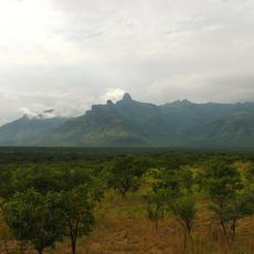
Mount Moroto
83.3 km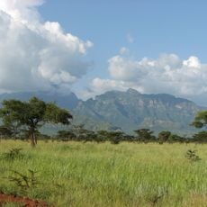
Mount Kadam
149.6 km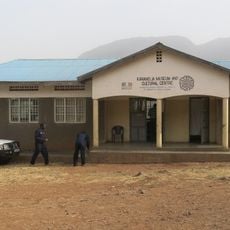
Karamoja Regional Museum
76.4 km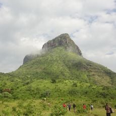
Akisim Mountain
98.6 km
Kaabong Seasonal River
58.8 km
St. Monica
58.5 km
Pian Upe Game Reserve
152.9 km
Karamoja Museum and Cultural Centre
76.3 km
Nakiloro Elder's Place
74.1 km
Kaabong Artificial Forest
56.7 km
St. Janan Luwum, Wii Gweng Mucwini Memorial Site
138.5 km
Kololo Rock
56.2 km
Kalokuruk Rock Sliding
8.5 km
Lomachariworet
57.2 km
Początek szlaku niebieskiego Bartka Zobka
144.1 km
Nataba Gate to KNP
86.6 km
Komuria Rock
57 km
Statue, Work of art
157.2 km
Bust, Work of art
115.9 km
Bust, Work of art
146.8 km
Bust, Work of art
88.1 km
Mountain, summit, hill, scenic viewpoint
99.1 km
Scenic viewpoint
90.5 km
Kyambogo University
156.7 km
Scenic viewpoint
147 km
Scenic viewpoint
148.4 km
Scenic viewpoint
147.3 km
Scenic viewpoint
92.8 kmVisited this place? Tap the stars to rate it and share your experience / photos with the community! Try now! You can cancel it anytime.
Discover hidden gems everywhere you go!
From secret cafés to breathtaking viewpoints, skip the crowded tourist spots and find places that match your style. Our app makes it easy with voice search, smart filtering, route optimization, and insider tips from travelers worldwide. Download now for the complete mobile experience.

A unique approach to discovering new places❞
— Le Figaro
All the places worth exploring❞
— France Info
A tailor-made excursion in just a few clicks❞
— 20 Minutes