Mufumbwe Council compound No5
Location: Mufumbwe District
GPS coordinates: -13.14104,25.00451
Latest update: October 27, 2025 20:40
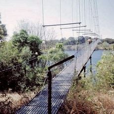
Chinyingi Bridge
217.2 km
Chitunta Plain Birding Area
194.8 km
Kikonge
47.2 km
Catholic harmermill
362 m
Mr Kuyokwas place
100.1 km
Kikonge School
40.5 km
Fuel deport
194.1 km
Half way point for 4.15 from g.house
1.9 km
Where we got blocked by a track
231.3 km
Cross Roads Solwezi
189.6 km
Black forest route
165.3 km
Ba Muzo's place
188 km
Kalengwa mine turnoff
15 km
Scenic viewpoint
212.9 km
Scenic viewpoint
218 km
Waterhole
215.9 km
Waterhole
217.9 km
Scenic viewpoint
205.6 km
Scenic viewpoint
208.5 km
Scenic viewpoint
177.2 km
Scenic viewpoint
184 km
Scenic viewpoint
184 km
Scenic viewpoint
232.6 km
Waterhole
232.4 km
Scenic viewpoint
198.4 km
Zambezi Source National Monument
211.2 km
Kapiamema Hot Spring
226.8 km
Monument
182.9 kmReviews
Visited this place? Tap the stars to rate it and share your experience / photos with the community! Try now! You can cancel it anytime.
Discover hidden gems everywhere you go!
From secret cafés to breathtaking viewpoints, skip the crowded tourist spots and find places that match your style. Our app makes it easy with voice search, smart filtering, route optimization, and insider tips from travelers worldwide. Download now for the complete mobile experience.

A unique approach to discovering new places❞
— Le Figaro
All the places worth exploring❞
— France Info
A tailor-made excursion in just a few clicks❞
— 20 Minutes