Kayak on the Jordan
Location: מועצה אזורית גליל עליון
GPS coordinates: 33.17667,35.61514
Latest update: November 12, 2025 02:01
Banyas
1.2 km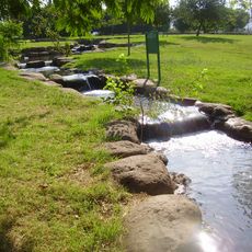
Hurshat Tal
5.1 km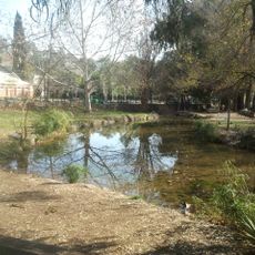
Park Hazahav
4.9 km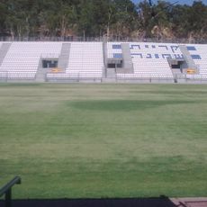
Kiryat Shmona Municipal Stadium
5.1 km
Shvil Ami Promenade
115 m
Tel Anafa
2.8 km
Most Josef
774 m
Tel Naama
1.9 km
Shemurat ‘En Awwazim
4.4 km
Shemurat ‘En Bedolaẖ
4.2 km
Shemurat Tel Anafa
2.3 km
The Great Rift Valley - migratory routes - The Hula
3.2 km
Shemurat Shamir Naẖal Raẖum
3.5 km
סינגל החצבני
3.9 km
תל קליל
3.8 km
פאמפטרק בית הלל
3.7 km
עין שחר
4.2 km
Ez Zawiya
3.3 km
El `Abisiya
3.1 km
Es Salihiya
1.1 km
Kanu
1.2 km
לאון בלום
645 m
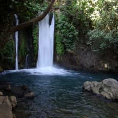
Waterfall
2.2 km
Waterfall
5 km
מפל בירדינון
4.5 km
Waterfall
504 m
Waterfall
947 m
Waterfall
4.2 kmReviews
Visited this place? Tap the stars to rate it and share your experience / photos with the community! Try now! You can cancel it anytime.
Discover hidden gems everywhere you go!
From secret cafés to breathtaking viewpoints, skip the crowded tourist spots and find places that match your style. Our app makes it easy with voice search, smart filtering, route optimization, and insider tips from travelers worldwide. Download now for the complete mobile experience.

A unique approach to discovering new places❞
— Le Figaro
All the places worth exploring❞
— France Info
A tailor-made excursion in just a few clicks❞
— 20 Minutes