מלכודת נמרים
Location: מועצה אזורית רמת נגב
GPS coordinates: 30.57804,34.57073
Latest update: October 15, 2025 21:42

Mount Harif
9.2 km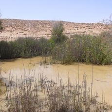
Lotz Cisterns
8.1 km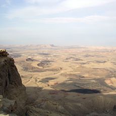
Har Ramon
10.5 km
Horsha Mountain Lookout
5.2 km
תצפית לבקעת קדש ברנע
7.4 km
תצפית פסגת הר חמרן
11.5 km
Karne Ramon Lookout
10.5 km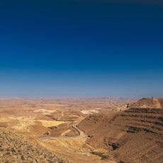
Scenic viewpoint
4.9 km
Archaeological site
10.7 km
Archaeological site
10.7 km
מצודת גזרון
5 km
עפיפון נחל חורשה צפון
9.5 km
Archaeological site
9.9 km
Scenic viewpoint
5.2 km
אנדרטה לזכר יאיר פלד
7.5 km
נואמיס
10.6 km
Archaeological site
10.6 km
אנדרטת ה"פוגה"
7.1 km
Archaeological site
10.7 km
חווה
8.3 km
Archaeological site
10.7 km
Archaeological site
10.8 km
Archaeological site
10.8 km
מצודת נחל עקרב
10.8 km
Ruins
11 km
Prism Canyon
11.2 km
נתנאל יהלומי
7.1 km
Arod viewpoint
11.6 kmReviews
Visited this place? Tap the stars to rate it and share your experience / photos with the community! Try now! You can cancel it anytime.
Discover hidden gems everywhere you go!
From secret cafés to breathtaking viewpoints, skip the crowded tourist spots and find places that match your style. Our app makes it easy with voice search, smart filtering, route optimization, and insider tips from travelers worldwide. Download now for the complete mobile experience.

A unique approach to discovering new places❞
— Le Figaro
All the places worth exploring❞
— France Info
A tailor-made excursion in just a few clicks❞
— 20 Minutes