קיקר
Location: מועצה אזורית משגב
GPS coordinates: 32.86358,35.24255
Latest update: November 12, 2025 19:11

Monkey Forest
4.1 km
Sakhnin (ancient village)
4.8 km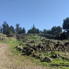
חורבת ראש זית
2.2 km
Shekhanya Mountain
2.2 km
Har Gilon
4.7 km
פארק אלעש
3.4 km
זוּחרקים
2.1 km
Michal lookout
4.8 km
Me‘arat Zakkay
2.8 km
Me‘arat H̱illazon Taẖtit
4.3 km
Me‘arat Ha'Esre
4.4 km
שער משני מנופים ישנים
4.1 km
באר אנטילייה
3 km
מגני יודפת
4.7 km
עלייה טכנית עם נוף מרהיב מערבה
4.5 km
גבעת ארבל
3 km
Scenic viewpoint
3 km
Scenic viewpoint
3.1 km
גבעת החרוב
3.5 km
המוזיאון האקולוגי
3.2 km
הדרך של בן
2.1 km
Scenic viewpoint
3.7 km
Scenic viewpoint
968 m
פינת המדורה
4.7 km
מקפצה
67 m
בית כנסת יודפת
4.6 km
Ruins
4.7 km
Ruins
4.7 kmReviews
Visited this place? Tap the stars to rate it and share your experience / photos with the community! Try now! You can cancel it anytime.
Discover hidden gems everywhere you go!
From secret cafés to breathtaking viewpoints, skip the crowded tourist spots and find places that match your style. Our app makes it easy with voice search, smart filtering, route optimization, and insider tips from travelers worldwide. Download now for the complete mobile experience.

A unique approach to discovering new places❞
— Le Figaro
All the places worth exploring❞
— France Info
A tailor-made excursion in just a few clicks❞
— 20 Minutes