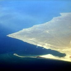
Devil's finger cliff
Location: Түпқараған ауданы
GPS coordinates: 44.16432,50.85305
Latest update: October 29, 2025 00:26
Fort-Shevchenko
61 km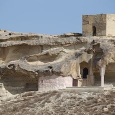
Shakpak-ata mosque
37.6 km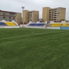
Zhastar Stadium
60.4 km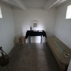
Taras Shevchenko museum
60.2 km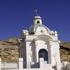
Armenian Chapel, Fort-Shevchenko
60.8 km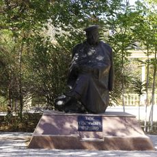
Taras Shevchenko haykali (Fort-Shevchenko)
60.1 km
Scenic viewpoint
48.8 km
Scenic viewpoint
7.9 km
Saura Canyon
8.2 km
Beach
7.2 km
Колея средневековых повозок
3 km
Kentti baba
35.1 km
Downhill to sea shore
49.5 km
Scenic viewpoint
8.5 km
Долина шаров
56.8 km
Scenic viewpoint
32 km
Scenic viewpoint
8.2 km
Shakpak-ata
37.6 km
Scenic viewpoint
32 km
Scenic viewpoint
48.8 km
Scenic viewpoint
32.4 km
Scenic viewpoint
7.6 km
Scenic viewpoint
49 km
Monument
60.9 km
Sultan upi
36.4 km
Isa-Dosan
60.5 km
Memorial
60.5 km
Шотан Нарарұлы
59.1 kmReviews
Visited this place? Tap the stars to rate it and share your experience / photos with the community! Try now! You can cancel it anytime.
Discover hidden gems everywhere you go!
From secret cafés to breathtaking viewpoints, skip the crowded tourist spots and find places that match your style. Our app makes it easy with voice search, smart filtering, route optimization, and insider tips from travelers worldwide. Download now for the complete mobile experience.

A unique approach to discovering new places❞
— Le Figaro
All the places worth exploring❞
— France Info
A tailor-made excursion in just a few clicks❞
— 20 Minutes