
Hanging bridge over Mai Khola
Location: Sandakpur-02
Location: Sandakpur
GPS coordinates: 27.04391,87.94659
Latest update: October 19, 2025 02:43
Falut
19.5 km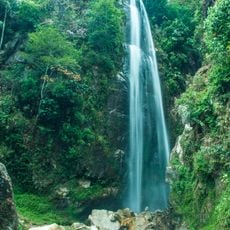
Todke waterfall
352 m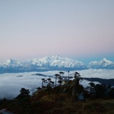
Sandakphu–Phalut Trek
14.4 km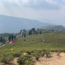
Tea garden view hand
15.1 km
Utise
3.3 km
Budhabare
2.1 km
Upper Mai Hydroelectric Project
2.4 km
Dobate
6.5 km
Tinkune, Mabu-9, Ilam
1.3 km
Sombare, Mabu-9, Ilam
1.3 km
Gagre Vanjyang
15.4 km
Ilam Chowk Bajar
15 km
Zero point Ilam
15.3 km
Dhobi dhara, Ilam
14.2 km
Chamaita
11.9 km
Mai Pokhari
4.5 km
Doser Chock
18.6 km
Mai Khola pul
17.9 km
Bhalu dhunga
13.5 km
Uttare pokhari
12.1 km
Memeng
16.6 km
Memeng
16.5 km
Scenic viewpoint
8.7 km
Scenic viewpoint
8.1 km
Scenic viewpoint
14.5 km
Maney Bhanjyang
18.3 km
Tumling
12.2 km
Chitrey
17.5 kmReviews
Visited this place? Tap the stars to rate it and share your experience / photos with the community! Try now! You can cancel it anytime.
Discover hidden gems everywhere you go!
From secret cafés to breathtaking viewpoints, skip the crowded tourist spots and find places that match your style. Our app makes it easy with voice search, smart filtering, route optimization, and insider tips from travelers worldwide. Download now for the complete mobile experience.

A unique approach to discovering new places❞
— Le Figaro
All the places worth exploring❞
— France Info
A tailor-made excursion in just a few clicks❞
— 20 Minutes