
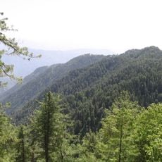
Hiking Track To Kashmir Point
Location: تحصیل مری
Address: Muzaffarabad Road
GPS coordinates: 33.91783,73.41818
Latest update: October 25, 2025 05:46
Ayubia National Park
16.2 km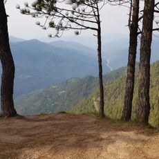
Panjpeer Rocks
22.8 km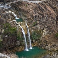
Sajikot Waterfall
15.9 km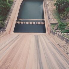
Simly Dam
23.3 km
Pindi Point
5.3 km
Murree Wildlife Park
5.3 km
Convent of Jesus and Mary, Murree
4.7 km
Simly Dam Lake
22.3 km
Murree Brewery ruins
6.7 km
Kashmir Point
1.3 km
Chitta morr
3.5 km
Kashmir Point
661 m
Sozo Adventure Park
3.3 km
Ghora Gali Chair Lift
5.2 km
Lipa Hut
1.8 km
Kohala Point
21.3 km
GPO chowk murree
2.5 km
Muree Waterfall
5.5 km
Pindi Point
4.5 km
Best dhaba
8.2 km
Habib Colony Chattar BBQ Point
19.6 km
Rahat Kada Guest House
3.4 km
Palace
24.3 km
Umbrella Waterfalls
14.3 km
NORTH HILLS
981 m
Simli Dam Viewpoint
22.4 km
Panjpeer Rocks
22.9 km
Scenic viewpoint
9 kmReviews
Visited this place? Tap the stars to rate it and share your experience / photos with the community! Try now! You can cancel it anytime.
Discover hidden gems everywhere you go!
From secret cafés to breathtaking viewpoints, skip the crowded tourist spots and find places that match your style. Our app makes it easy with voice search, smart filtering, route optimization, and insider tips from travelers worldwide. Download now for the complete mobile experience.

A unique approach to discovering new places❞
— Le Figaro
All the places worth exploring❞
— France Info
A tailor-made excursion in just a few clicks❞
— 20 Minutes