
Way in floen beach resort
Location: Bagac
Address: 147 km 147 km Saysayin
GPS coordinates: 14.57260,120.39252
Latest update: October 26, 2025 23:12
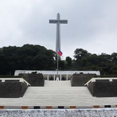
Mount Samat National Shrine
13.1 km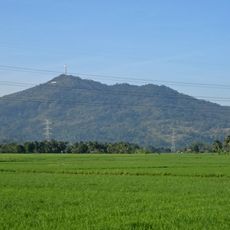
Mount Samat
12.9 km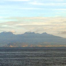
Mount Mariveles
10.8 km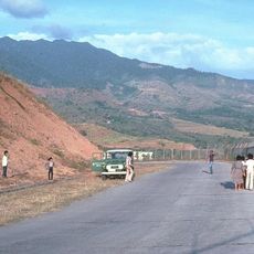
Bataan National Park
12.6 km
Philippine–Japanese Friendship Tower
3.7 km
Casa Bizantina
3 km
Casa Hidalgo
3.1 km
Casa Unisan
3 km
Casa Jaen I
3.1 km
Ambon-Ambon Falls
11.5 km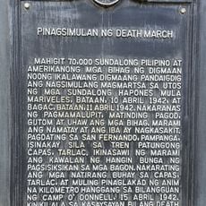
Starting Point of Death March historical marker
3 km
Dunsulan Park
11.7 km
Scenic viewpoint
11.7 km
Salaman turn off
929 m
Dunsulan Falls
11.8 km
Oyster Island
8 km
Auspina Eco Resort
6.9 km
Auspina Eco Resort
6.9 km
Philippines-Japan Friendship Tower
3.7 km
Mount Samat National Shrine
13.1 km
Bisay waterfalls
1.6 km
Kilabot Ridge
10.1 km
Mag Asawang Bato
9.5 km
Mount Mariveles
12.5 km
Dunsulan Falls
11.8 km
Dambana ng Kagitingan
13.1 km
Magbuo Highlands
6.1 km
Scenic viewpoint
12.2 kmReviews
Visited this place? Tap the stars to rate it and share your experience / photos with the community! Try now! You can cancel it anytime.
Discover hidden gems everywhere you go!
From secret cafés to breathtaking viewpoints, skip the crowded tourist spots and find places that match your style. Our app makes it easy with voice search, smart filtering, route optimization, and insider tips from travelers worldwide. Download now for the complete mobile experience.

A unique approach to discovering new places❞
— Le Figaro
All the places worth exploring❞
— France Info
A tailor-made excursion in just a few clicks❞
— 20 Minutes