Японское кладбище
Location: Южно-Курильский городской округ
GPS coordinates: 43.80829,146.83060
Latest update: November 15, 2025 06:38
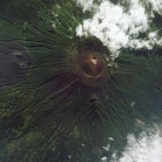
Tyatya
76.3 km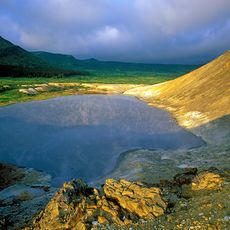
Kurils Nature Reserve
74.5 km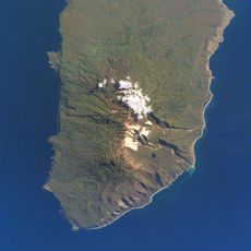
Berutarube
74.1 km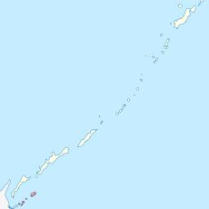
Lesser Kurils Zakaznik
41.8 km
Gora Sernaya
73.7 km
Ванночки Чайка
78.4 km
Shikotan
6.3 km
Японские дома
7.8 km
Засели
10.4 km
RTOT 2
8.2 km
Шикотан - начало России
6.8 km
Останки вертолёта Ми-8, разбившегося 10.01.1983г
75.8 km
Здесь есть связь
76.8 km
Заправочный бак от самолёта
77.3 km
Канатка
7.7 km
Habomai islets
64.8 km
Грот
3.9 km
Место причала лодки
67.8 km
Scenic viewpoint
4.2 km
Scenic viewpoint
7.8 km
Scenic viewpoint
8.9 km
Scenic viewpoint
4.1 km
Scenic viewpoint
8 km
Экспедиции Шпанберга
6.8 km
Танк
6.4 km
В. И. Ленину
81.3 km
Мемориал "Слава героям"
81.2 km
Ruins
7.4 kmReviews
Visited this place? Tap the stars to rate it and share your experience / photos with the community! Try now! You can cancel it anytime.
Discover hidden gems everywhere you go!
From secret cafés to breathtaking viewpoints, skip the crowded tourist spots and find places that match your style. Our app makes it easy with voice search, smart filtering, route optimization, and insider tips from travelers worldwide. Download now for the complete mobile experience.

A unique approach to discovering new places❞
— Le Figaro
All the places worth exploring❞
— France Info
A tailor-made excursion in just a few clicks❞
— 20 Minutes