
Tham Pla cave
Location: จังหวัดแม่ฮ่องสอน
GPS coordinates: 19.42727,97.99049
Latest update: October 15, 2025 22:11
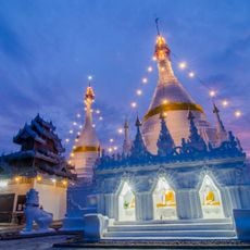
Wat Phra That Doi Kong Mu
14.5 km
Wat Chong Kham
14.6 km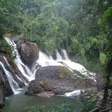
Tham Pla - Namtok Pha Suea National Park
8.5 km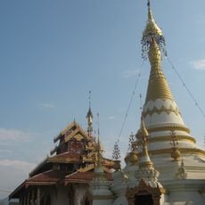
Wat Hua Wiang
14.2 km
Wat Pang Mu
8.4 km
Wat Klang Thung
14.2 km
Wat Kung Pao
13.7 km
Wat Mae Sangkha
4 km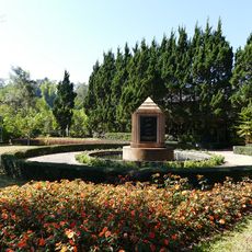
Pang Tong Palace
9.6 km
Wat Chong Klang
14.6 km
Nam Tok Pha Suea
8 km
MHS CERT 1
14.5 km
Scenic viewpoint
14.5 km
Zoo
10.1 km
Maehongson Bamboo Complex
9.6 km
MAE HONG SON CERT
14.2 km
Helicopter landing pad
9.6 km
Memorial
14.4 km
Scenic viewpoint
14.5 km
Scenic viewpoint
11.6 km
Scenic viewpoint
13.4 km
Mural and flags street
14.5 km
Wat Pha Ang
12.5 km
Scenic viewpoint
14.5 km
ดอยทูคู
14.5 km
Last Sunset of Thailand
14.6 km
Free Looking
7.9 km
Pang Oung
11.6 kmReviews
Visited this place? Tap the stars to rate it and share your experience / photos with the community! Try now! You can cancel it anytime.
Discover hidden gems everywhere you go!
From secret cafés to breathtaking viewpoints, skip the crowded tourist spots and find places that match your style. Our app makes it easy with voice search, smart filtering, route optimization, and insider tips from travelers worldwide. Download now for the complete mobile experience.

A unique approach to discovering new places❞
— Le Figaro
All the places worth exploring❞
— France Info
A tailor-made excursion in just a few clicks❞
— 20 Minutes