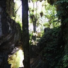
Natural tunnel
Location: Waitomo District
GPS coordinates: -38.25219,174.93460
Latest update: October 11, 2024 01:33
Mangapohue Natural Bridge
3.1 km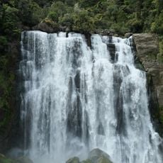
Marokopa Falls
7.3 km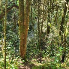
Tawarau Conservation Area
8.4 km
Upper Double Falls
6.8 km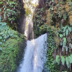
Tawarau Falls
7.3 km
Lower Double Falls
6.8 km
Piripiri Caves
7.3 km
Umutoatoa Scenic Reserve
4.4 km
Mangapohue Natural Bridge Scenic Reserve
3.1 km
Ngahuinga Bluff Scenic Reserve
9.2 km
Marokopa Natural Tunnel Scenic Reserve
472 m
Marokopa Falls Scenic Reserve
7.4 km
Piripiri Caves Scenic Reserve
6.4 km
Hollow Hill Scenic Reserve
7.8 km
Pa
4.4 km
Putaki Scenic Reserve
7.3 km
Taumatatotara East Scenic Reserve
8.3 km
Scenic Reserve - Hauturu East
8.4 km
Waiharakeke Stream Scenic Reserve
9.2 km
Mangapohue Natural Bridge
3 km
Scenic viewpoint
7.3 km
Waterfall
3.9 km
Marokopa Falls
7.4 km
Waterfall
4.6 km
Haggas Lookout
8.2 km
Shoes fence
4.6 km
Waterfall
6.5 km
Waterfall
9 kmReviews
Visited this place? Tap the stars to rate it and share your experience / photos with the community! Try now! You can cancel it anytime.
Discover hidden gems everywhere you go!
From secret cafés to breathtaking viewpoints, skip the crowded tourist spots and find places that match your style. Our app makes it easy with voice search, smart filtering, route optimization, and insider tips from travelers worldwide. Download now for the complete mobile experience.

A unique approach to discovering new places❞
— Le Figaro
All the places worth exploring❞
— France Info
A tailor-made excursion in just a few clicks❞
— 20 Minutes