Rokewood Lagoon
Location: Rokewood
Location: Golden Plains Shire
GPS coordinates: -37.90102,143.72557
Latest update: November 21, 2025 15:45
Glenmona Bridge
16 km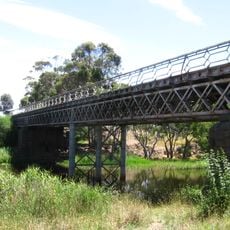
Pitfield Bridge
16 km
Mount Mercer
15.2 km
Mount Misery
15 km
Mount Rebecca
15 km
Mount Cockatoo
14.2 km
McMillans Bridge
6.5 km
Glenfine Homestead Precinct
13 km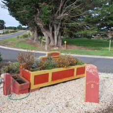
Cast Iron Mileposts, Cape Clear
16.1 km
Former Leigh Shire Hall and Toll House
12.7 km
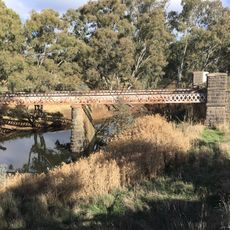
Mt. Misery Creek Bridge
12 km
Barunah Plains North Soldiers Settlement Memorial
14.7 km
Good shed
4.6 km
Goods Shed
9.9 km
Rokewood Golf Club
916 m
Tanks
13.1 km
Mining remnants
14.7 km
Illabarook & Rokewood Junction War Memorial
9.6 km
Werneth 1914-1918 Avenue of Honour
11 km
Mt. Misery Creek Bridge
12.1 km
Mining Ruins
15.3 km
Mining Ruins
14.6 km
Mining Ruins
14.7 km
Mining Ruins
14.6 km
Rokewood War Memorial
426 m
Rokewood Soldier Settlement Memorial
3 km
Old Pitfield Plains Mining Area
14.2 km
Old Italian Mining Area
15.4 kmReviews
Visited this place? Tap the stars to rate it and share your experience / photos with the community! Try now! You can cancel it anytime.
Discover hidden gems everywhere you go!
From secret cafés to breathtaking viewpoints, skip the crowded tourist spots and find places that match your style. Our app makes it easy with voice search, smart filtering, route optimization, and insider tips from travelers worldwide. Download now for the complete mobile experience.

A unique approach to discovering new places❞
— Le Figaro
All the places worth exploring❞
— France Info
A tailor-made excursion in just a few clicks❞
— 20 Minutes