Rastkreuz
Location: Grünbach am Schneeberg
GPS coordinates: 47.81094,15.98015
Latest update: October 11, 2024 01:52
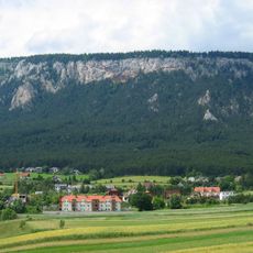
Hohe Wand
1.8 km
Burgruine Stolzenwörth
1.8 km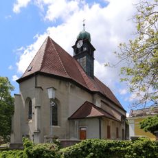
Saint Michael Church (Grünbach am Schneeberg)
1.6 km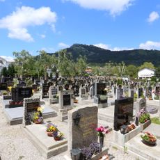
Friedhof
1.5 km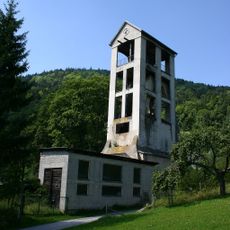
Förderturm des ehem. Steinkohlebergwerks
642 m
Scenic viewpoint
1.4 km
Kriegerdenkmal
1.6 km
Höhlenbär
970 m
Kremerkreuz
1 km
Work of art, sculpture
1 km
Judith Kremer
1 km
Wayside shrine
1.1 km
Wayside shrine
1.2 km
Bärenhöhle
933 m
Bench, scenic viewpoint
918 m
Wayside shrine
825 m
Scenic viewpoint
955 m
Kienberg
779 m
Scheimhitt'n
48 m
Wayside cross
1.8 km
Talbauernkreuz
1.8 km
Wayside cross
1.8 km
ÖTK-Kugel
1.9 km
Pestkreuz
1.9 km
Scenic viewpoint
1.9 km
Wayside shrine, Christianity
1.9 km
Bäumlkreuz
1.9 km
Wayside shrine
2.1 kmReviews
Visited this place? Tap the stars to rate it and share your experience / photos with the community! Try now! You can cancel it anytime.
Discover hidden gems everywhere you go!
From secret cafés to breathtaking viewpoints, skip the crowded tourist spots and find places that match your style. Our app makes it easy with voice search, smart filtering, route optimization, and insider tips from travelers worldwide. Download now for the complete mobile experience.

A unique approach to discovering new places❞
— Le Figaro
All the places worth exploring❞
— France Info
A tailor-made excursion in just a few clicks❞
— 20 Minutes