Будынак пач.20ст.
Location: Радашковіцкі сельскі Савет
GPS coordinates: 54.10212,27.15873
Latest update: October 11, 2024 02:13
Памятник Янке Купале (Вязынка)
2.6 km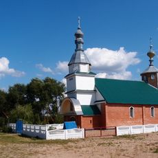
Orthodox church of the Nativity of Our Lady in Dubrava
3.9 km
Wayside cross
2 km
Memorial, commemorative plaque
2.6 km
Wayside cross
1.7 km
Scenic viewpoint
1.8 km
Магіла невядомага салдата
1.3 km
Ледниковый конгломерат
2.1 km
Пясчаны карʼер
2.2 km
Від на карʼер
2.3 km
Від на карʼер
2.3 km
Memorial stone, memorial
2.4 km
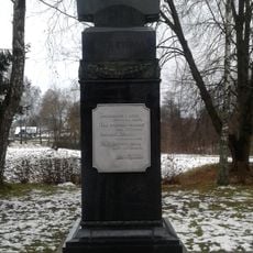
Янка Купала
2.6 km
Брама
881 m
Ручной калодзеж
2.6 km
Scenic viewpoint
1.5 km
Słup
2.6 km
The house were Janka Kupala was born
2.6 km
Sviran (a granary). Reconstruction of the building eanrly XIX century
2.6 km
The ruins of the manor house of Zambzycki family
2.6 km
Office building. The bulding of a kitchen of the Border Protection Corps (Polish: Korpus Ochorony Pogranicza, KOP). 1930s
2.7 km
Muzeum-Dwór Janki Kupały
2.7 km
Memorial stone, memorial
2.8 km
Гарадзішча II-IV ст. н. э.
2.9 km
Memorial stone, memorial
2.9 km
Руіны хутара
3.6 km
City gate
633 m
War memorial, memorial
4.3 kmReviews
Visited this place? Tap the stars to rate it and share your experience / photos with the community! Try now! You can cancel it anytime.
Discover hidden gems everywhere you go!
From secret cafés to breathtaking viewpoints, skip the crowded tourist spots and find places that match your style. Our app makes it easy with voice search, smart filtering, route optimization, and insider tips from travelers worldwide. Download now for the complete mobile experience.

A unique approach to discovering new places❞
— Le Figaro
All the places worth exploring❞
— France Info
A tailor-made excursion in just a few clicks❞
— 20 Minutes