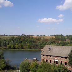
Водяний млин
Location: Сокілець
Location: Немирівська міська громада
GPS coordinates: 48.85909,28.72838
Latest update: November 17, 2025 07:58
Bratslav
16.6 km
Grodzisko scytyjskie
15.5 km
Shcherbatova Palace
14.7 km
Shpykiv
14.5 km
Zamek w Bracławiu
16.6 km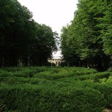
Nemyriv park
14.7 km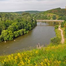
Nemyrivske pobuzhzhia
14.8 km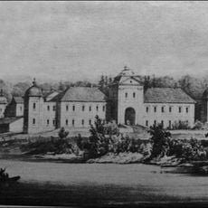
Palace in Shpykiv
14.5 km
Pechera park
1.3 km
Bratslav water mill and Power plant
14 km
Bratslavska Dubyna
9.8 km
Prybuzkyi zakaznyk
622 m
Nemyrivske horodyshche
15 km
Dzherelo Revukha
8.6 km
Sokiletskyi Park
826 m
Zakruta
6.1 km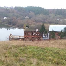
Watermill in Bratslav
16.8 km
Luhy
9 km
Mazurovetska dubyna
3.4 km
Ustia
15.8 km
Watermill and power plant in Sokilets
36 m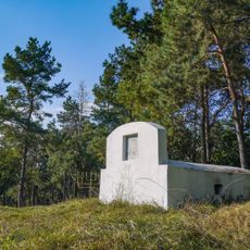
Jewish cemetery in Nemyriv, Vinnytsia Oblast
15.3 km
Mauzoleum Potockich w Peczerze
1.4 km
Млин
11.6 km
БРАЦLOVE
15.9 km
Kościół pw. Matki Boskiej Szkaplerznej
16.3 km
Synagoga w Bracławiu
16.2 km
Scenic viewpoint
15.1 kmVisited this place? Tap the stars to rate it and share your experience / photos with the community! Try now! You can cancel it anytime.
Discover hidden gems everywhere you go!
From secret cafés to breathtaking viewpoints, skip the crowded tourist spots and find places that match your style. Our app makes it easy with voice search, smart filtering, route optimization, and insider tips from travelers worldwide. Download now for the complete mobile experience.

A unique approach to discovering new places❞
— Le Figaro
All the places worth exploring❞
— France Info
A tailor-made excursion in just a few clicks❞
— 20 Minutes