
Freier Seezugang Millstättersee nahe Schiffsanlegestelle Dellach-Sappl
Freier Seezugang Millstättersee nahe Schiffsanlegestelle Dellach-Sappl
Website: https://gis.ktn.gv.at/leaflet/Fotoseezu/bad_4.pdf
GPS coordinates: 46.79303,13.60562
Latest update: November 29, 2025 08:33
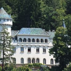
Schloss Heroldeck
1.7 km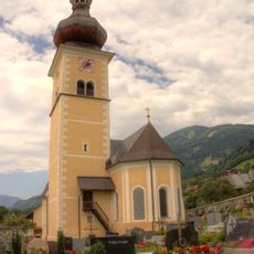
Kirche in Obermillstatt
2.1 km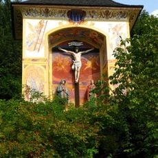
Hohes Kreuz
2.2 km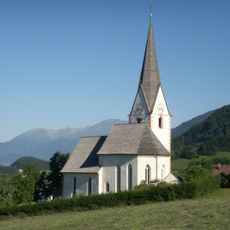
Kirche Maria Schnee in Matzelsdorf
2.3 km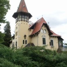
Villa Verdin
2.4 km
Villa Mimi
2.3 km
Villa Luisenheim, Millstatt
2.7 km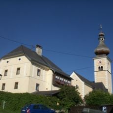
Pfarrhof Obermillstatt
2.1 km
Benediktinerinnenkloster Millstatt, Österreich
2.3 km
Scenic viewpoint
1.9 km
Wayside shrine, Christianity
1.9 km
San Daniele del Friuli
2.2 km
Work of art
2.3 km
Kanzel
1.1 km
Strandbad Pesenthein
657 m
Scenic viewpoint
1.6 km
Wayside shrine
800 m
Matzelsdorfer Kreuz
2.5 km
Ohne Namen
2.2 km
Faberkreuz
2.4 km
Görtschacher Kreuz
852 m
Wayside shrine, Christianity
2.1 km
Wayside cross
862 m
Wayside cross
1.5 km
WW2 memorial
2.2 km
Wayside cross
1.8 km
Place of worship, wayside shrine, house of prayer
1.8 km
Waterfall
1 kmReviews
Visited this place? Tap the stars to rate it and share your experience / photos with the community! Try now! You can cancel it anytime.
Discover hidden gems everywhere you go!
From secret cafés to breathtaking viewpoints, skip the crowded tourist spots and find places that match your style. Our app makes it easy with voice search, smart filtering, route optimization, and insider tips from travelers worldwide. Download now for the complete mobile experience.

A unique approach to discovering new places❞
— Le Figaro
All the places worth exploring❞
— France Info
A tailor-made excursion in just a few clicks❞
— 20 Minutes