Freibad Waldhausen
Location: Waldhausen
Website: http://waldhausen.gv.at/page.asp/-/freibad
GPS coordinates: 48.52233,15.26376
Latest update: November 16, 2025 04:29
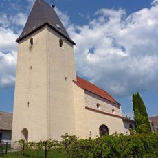
Filialkirche Obernondorf
2 km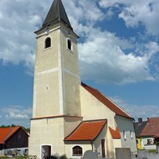
Kath. Pfarrkirche hll. Petrus und Paulus und Friedhof
192 m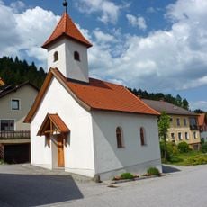
Ortskapelle hl. Maria Hilfe der Christenheit
1.6 km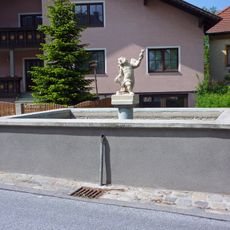
Brunnen
197 m
Kriegerdenkmal
1.7 km
Wayside shrine
1.2 km
Wayside cross
2.1 km
Wayside cross
877 m
Christianity, wayside shrine
2.1 km
Wayside cross
935 m
Rauchfangkehrer-Marterl
933 m
Wayside cross
2.5 km
Wayside shrine
1.2 km
Wayside cross
1.2 km
Scenic viewpoint
1.1 km
Wayside cross
2.2 km
Kriegerdenkmal
193 m
Wayside shrine, Christianity
915 m
Tree, wayside shrine
2 km
Wayside cross
2.1 km
Wayside cross
1.9 km
Wayside shrine
1.5 km
Wayside cross
2.1 km
Wayside shrine
1.8 km
Tree, wayside shrine
2.1 km
Wayside cross
1.4 km
Tree, wayside shrine, Christianity
430 m
Friedhofskreuz
206 mVisited this place? Tap the stars to rate it and share your experience / photos with the community! Try now! You can cancel it anytime.
Discover hidden gems everywhere you go!
From secret cafés to breathtaking viewpoints, skip the crowded tourist spots and find places that match your style. Our app makes it easy with voice search, smart filtering, route optimization, and insider tips from travelers worldwide. Download now for the complete mobile experience.

A unique approach to discovering new places❞
— Le Figaro
All the places worth exploring❞
— France Info
A tailor-made excursion in just a few clicks❞
— 20 Minutes