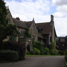
The Abbey, Storrington
2.3 km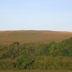
Prehistoric flint mine and a Martin Down style enclosure on Harrow hill, 850m south east of Lee Farm
2.3 km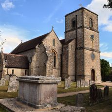
The Parish Church of St Mary the Virgin
2.4 km
Church of St Peter, Parham
2.4 km
Pair of platform barrows on the western side of Kithurst Hill car park: part of a dispersed round barrow cemetery on Kithurst Hi
520 m
Rising Sun Cottage
2.5 km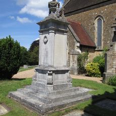
Storrington War Memorial
2.4 km
Ladye Place
2.5 km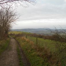
Rackham Banks: A cross dyke and Itford Hill style settlement on Rackham Hill, 900m SSE of Oldbottom Barn
2.2 km
Linear group of three bowl barrows immediately east of Kithurst Hill car park: part of a dispersed round barrow cemetery on Kith
402 m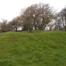
Bowl barrow on Springhead Hill, 750m SSW of Springhead Farm
1.4 km
Bowl barrow at Kithurst Hill car park: part of a dispersed round barrow cemetery on Kithurst Hill
444 m
Group of four bowl barrows at the Chantry Post
1.5 km
Bowl barrow 950m south west of Grey Friars Farm: part of a dispersed round barrow cemetery on Kithurst Hill
609 m
Cross dyke on Chantry Hill, 470m south of Grey Friars Farm
1.3 km
Group of six bowl barrows 790m south west of Grey Friars Farm: part of a dispersed round barrow cemetery on Kithurst Hill
770 m
Prehistoric linear boundary on Wepham Down
2.4 km
An unenclosed Iron Age urnfield and associated remains on Rackham Hill, 900m SSE of Rackham Farm
2 km
Cross dyke on Springhead Hill, 780m south of Springhead Farm
1.2 km
Rod Cottage
2.2 km
Waterfall Cottage
2.2 km
Cootham House
2 km
Cobb Court
2.2 km
The Horsecroft
2.4 km
St Josephs Hall
2.1 km
Pair Of Cottages And Attached Wall At St Joseph's Hall
2.1 km
Abbey Convent
2.3 km
Springhead Farmhouse
1.7 kmReviews
Visited this place? Tap the stars to rate it and share your experience / photos with the community! Try now! You can cancel it anytime.
Discover hidden gems everywhere you go!
From secret cafés to breathtaking viewpoints, skip the crowded tourist spots and find places that match your style. Our app makes it easy with voice search, smart filtering, route optimization, and insider tips from travelers worldwide. Download now for the complete mobile experience.

A unique approach to discovering new places❞
— Le Figaro
All the places worth exploring❞
— France Info
A tailor-made excursion in just a few clicks❞
— 20 Minutes