Lhasa
Location: Piriyapattana taluk
GPS coordinates: 12.43082,75.96774
Latest update: November 11, 2025 19:38
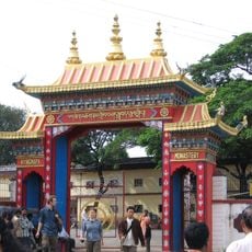
Namdroling Monastery
54 m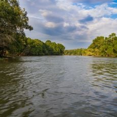
Dubare
9.7 km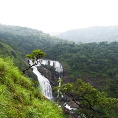
Mallalli Falls
21.6 km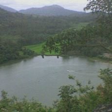
Honnamana Kere
23.2 km
Sidlu Mallikarjuna Temple
16.3 km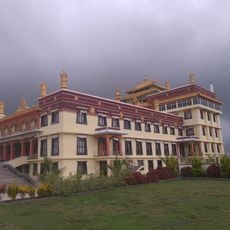
Tashi Lhunpo Monastery
2 km
Hosa Kere
2.7 km
Arasina Kere
13.8 km
Kappalu Kere
20.5 km
Dandenamana Kere
8.6 km
Saragandi Kere
7.2 km
Hari Kinnigana Kere
23.1 km
Chickaimotte Kere
8.8 km
Chaudi Kere
4.7 km
Sunkal Kere
2.9 km
Halagote Dod Kere
12.8 km
Munchadevar Kere
10.2 km
Balē Katte
2.8 km
Valagunda Kere
21 km
Tati Kere
9 km
Kunchi Katte
4 km
Devee Kere
6.6 km
Devamachi Kere
15.2 km
Koteherur Kere
10.1 km
Cholana Kere
8.1 km
Dubare Elephant Camp
9.5 km
Hanging Bridge
4.7 km
Statue, Work of art
24.7 kmReviews
Visited this place? Tap the stars to rate it and share your experience / photos with the community! Try now! You can cancel it anytime.
Discover hidden gems everywhere you go!
From secret cafés to breathtaking viewpoints, skip the crowded tourist spots and find places that match your style. Our app makes it easy with voice search, smart filtering, route optimization, and insider tips from travelers worldwide. Download now for the complete mobile experience.

A unique approach to discovering new places❞
— Le Figaro
All the places worth exploring❞
— France Info
A tailor-made excursion in just a few clicks❞
— 20 Minutes