Landfall
Location: Whangārei District
Inception: January 1, 2011
Creator: Justin Murfitt
Creator: Justin Murfitt
GPS coordinates: -35.72707,174.33069
Latest update: November 14, 2025 05:01
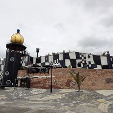
Hundertwasser Art Centre
593 m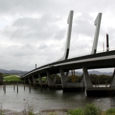
Te Matau ā Pohe
975 m
Ross Park Cascade
1.1 km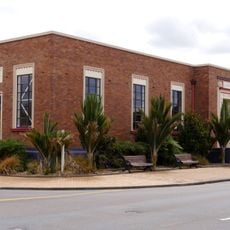
Whangārei Central Library
1.2 km
Whangarei Art Museum
515 m
Whangarei Central Library
1.2 km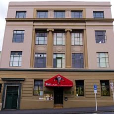
Public Trust Office
1.1 km
Keyte’s Barn (Former)
1.2 km
Harding Army Hall
660 m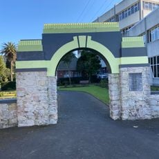
Hugh Crawford memorial gate
1.2 km
Reyburn House
312 m
House (12 Aubrey Street and Norfolk Street)
1.2 km
House (19 Aubrey Street)
1.2 km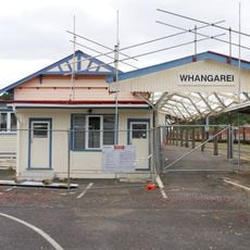
Whangarei railway station
774 m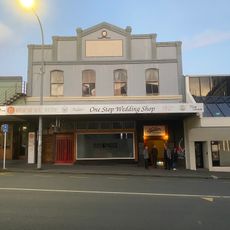
Butter Factory
1 km
Gallery (For Lease)
1.1 km
MD Gallery
1.1 km
Northland Rugby
760 m
Punga
119 m
Kaitiaki Manu
76 m
Legend of Reitu and Reipae
20 m
About time Rolling Ball Clock
421 m
Aurere - Journey of the Waka
64 m
Camera Obscura Timatatanga Hou
967 m
Work of art
82 m
Work of art
339 m
Whangārei First World War Memorial
1 km
Whangārei War Memorial
1 kmReviews
Visited this place? Tap the stars to rate it and share your experience / photos with the community! Try now! You can cancel it anytime.
Discover hidden gems everywhere you go!
From secret cafés to breathtaking viewpoints, skip the crowded tourist spots and find places that match your style. Our app makes it easy with voice search, smart filtering, route optimization, and insider tips from travelers worldwide. Download now for the complete mobile experience.

A unique approach to discovering new places❞
— Le Figaro
All the places worth exploring❞
— France Info
A tailor-made excursion in just a few clicks❞
— 20 Minutes