Almochse
Location: Fladnitz an der Teichalm
GPS coordinates: 47.34974,15.46484
Latest update: July 20, 2025 13:57
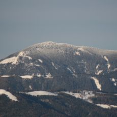
Hochlantsch
3.4 km
Osser
2.8 km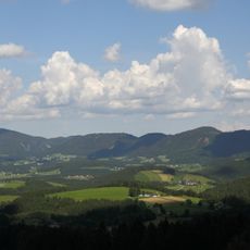
Naturpark Almenland
183 m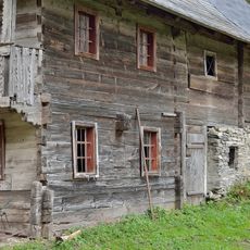
Bauernhaus Ebenhiasl, Breitenau
3.9 km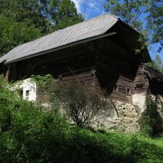
Bauernhof Grabenbauer
3.5 km
Scenic viewpoint
1.8 km
Bench, scenic viewpoint
367 m
Eisfall Alice
1.9 km
Scenic viewpoint
1.9 km
Gerlerkreuz
1.9 km
Zachenkreuz
2.3 km
Wayside cross
2.3 km
Scenic viewpoint
2.3 km
Wayside shrine
552 m
Wayside cross
3 km
Ökopark Hochreiter
3 km
Broatalmkreuz
1.2 km
Wayside cross
354 m
Scenic viewpoint
3.5 km
Memorial
3.6 km
Scenic viewpoint
3.7 km
Birkhahnkreuz
3.8 km
Schwobauerkreuz (1249m)
3.8 km
Wayside cross
3.8 km
Wayside cross
3.9 km
Scenic viewpoint
296 m
Wayside cross
4 km
Wayside shrine
4 kmReviews
Visited this place? Tap the stars to rate it and share your experience / photos with the community! Try now! You can cancel it anytime.
Discover hidden gems everywhere you go!
From secret cafés to breathtaking viewpoints, skip the crowded tourist spots and find places that match your style. Our app makes it easy with voice search, smart filtering, route optimization, and insider tips from travelers worldwide. Download now for the complete mobile experience.

A unique approach to discovering new places❞
— Le Figaro
All the places worth exploring❞
— France Info
A tailor-made excursion in just a few clicks❞
— 20 Minutes