Le tambour
Location: Vaulnaveys-le-Haut
Made from material: wood
GPS coordinates: 45.09884,5.84538
Latest update: July 20, 2025 15:11
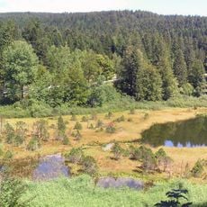
Réserve naturelle nationale du lac Luitel
1.2 km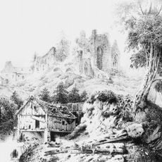
Chartreuse de Prémol
255 m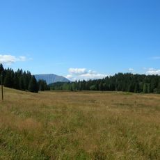
Tourbière de l'Arselle
2.6 km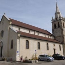
Église Saint-Jean-Baptiste de Vaulnaveys-le-Haut
3.5 km
Drinking fountain, water well
3.5 km
Rocher de l'Homme
3.9 km
Pic de l'Oeilly
1.4 km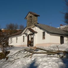
Chapelle Notre-Dame-des-Neiges du Recoin
3.7 km
Scenic viewpoint
1.5 km
Scenic viewpoint
2.5 km
Panorama sur Vizille
3.8 km
Scenic viewpoint
3.7 km
Belvédère EDF
3.7 km
Stele, memorial
2.6 km
Le diapason
147 m
Croix en bois
2.6 km
Les transats
164 m
Ruins
3.1 km
Scenic viewpoint
3.4 km
Ancien maison en ruine
3.5 km
L'Arbrasson
179 m
Le cyclone
132 m
Wayside cross
1.7 km
La chouette et l'eau
256 m
Chartreuse de Prémol
251 m
Waterfall
468 m
Sculpture, Work of art
3.8 km
La Chartreuse
206 mReviews
Visited this place? Tap the stars to rate it and share your experience / photos with the community! Try now! You can cancel it anytime.
Discover hidden gems everywhere you go!
From secret cafés to breathtaking viewpoints, skip the crowded tourist spots and find places that match your style. Our app makes it easy with voice search, smart filtering, route optimization, and insider tips from travelers worldwide. Download now for the complete mobile experience.

A unique approach to discovering new places❞
— Le Figaro
All the places worth exploring❞
— France Info
A tailor-made excursion in just a few clicks❞
— 20 Minutes