Ps in a Pod
Location: County Durham
Creator: Louise Plant
Creator: Louise Plant
GPS coordinates: 54.78013,-1.58264
Latest update: November 12, 2025 09:16
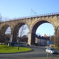
Durham Viaduct
345 m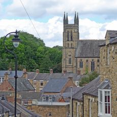
Church of St.Godric
279 m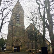
Church of St Cuthbert
296 m
North Road Methodist Church
278 m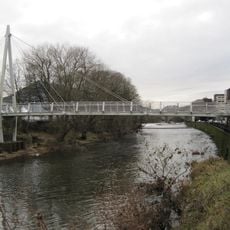
Penny Ferry Bridge
386 m
Obelisk
259 m
The Grey Tower
185 m
Fram Well Head
173 m
Boundary Stone About 40 Metres North Of Junction With Obelisk Lane
211 m
Former Miner's Hall (Ristorante La Cantina)
379 m
27, North Road
289 m
Durham Railway Station Front Range
130 m
United Bus Company Canteen
376 m
Durham Railway Station West Range And Canopy
58 m
Castle Chare Community Arts Centre
327 m
Premises Occupied By Messrs. J.And M. Luke At Junction Of Sutton Street
259 m
Globe Cinema
281 m
War Memorial in the Churchyard of the Church of Our Lady of Mercy and St Godric
261 m
Robins Cinema
367 m
The Battery In Wharton Park
103 m
Lych Gate West of Church of St. Cuthbert
313 m
The Way
29 m
Durham Picture Frame
49 m
William Wharton
90 m
Albert the Good
117 m
Mosaic, Work of art
115 m
Scenic viewpoint
105 m
Scenic viewpoint
299 mReviews
Visited this place? Tap the stars to rate it and share your experience / photos with the community! Try now! You can cancel it anytime.
Discover hidden gems everywhere you go!
From secret cafés to breathtaking viewpoints, skip the crowded tourist spots and find places that match your style. Our app makes it easy with voice search, smart filtering, route optimization, and insider tips from travelers worldwide. Download now for the complete mobile experience.

A unique approach to discovering new places❞
— Le Figaro
All the places worth exploring❞
— France Info
A tailor-made excursion in just a few clicks❞
— 20 Minutes