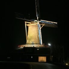
Saturnus
Location: Molenlanden
Creator: Jolanda Riedijk
Creator: Jolanda Riedijk
GPS coordinates: 51.84882,4.74109
Latest update: November 14, 2025 06:15
De Hoop
1.4 km
Wingerdse Molen
1.3 km
De Peilmolen
1.3 km
Tjasker Bleskensgraaf
1.3 km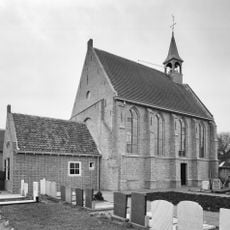
Nederlands Hervormde Kerk, Wijgaarden
1.6 km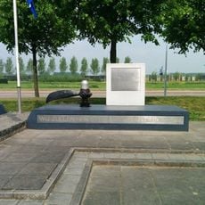
Lancaster-monument
2 km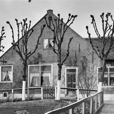
Noordzijde 20, Oud-Alblas
1.9 km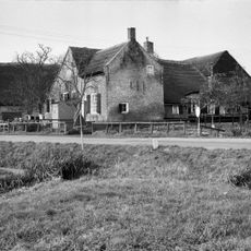
Oosteinde 18, Oud-Alblas
1.6 km
Oosteinde 14, Oud-Alblas
1.6 km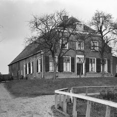
Oosteinde 58, Oud-Alblas
2.4 km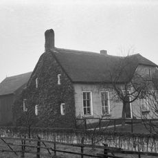
Boerderij met rechts afgeknotte puntgevel en links uitbouw onder zadeldak evenwijdig aan de straat
1.6 km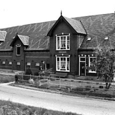
Boerderij van het dwarsdeeltype met een T-vormige plattegrond. Het pand is gebouwd in Traditioneel Ambachtelijke stijl
2.5 km
Oosteinde 15, Oud-Alblas
1.6 km
Terrein waarin sporen van bewoning
461 m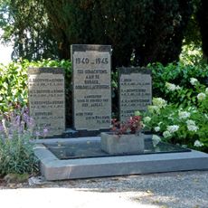
Oorlogsmonument
2 km
Grote boerderij met rieten zadeldak en woongedeelte met hoge, Ysselstenen puntgevel met vlechtingen. Vensters met luiken en zesruitsschuiframen
1.6 km
Labyrint
550 m
Uranus
588 m
Jupiter
470 m
Neptunus
601 m
Project Pyramide
533 m
Venus
575 m
Mercurius
589 m
Aarde
549 m
Mars
512 m
Planetoïde gordel
402 m
Sculpture, Work of art
432 m
Work of art, statue
1.5 kmReviews
Visited this place? Tap the stars to rate it and share your experience / photos with the community! Try now! You can cancel it anytime.
Discover hidden gems everywhere you go!
From secret cafés to breathtaking viewpoints, skip the crowded tourist spots and find places that match your style. Our app makes it easy with voice search, smart filtering, route optimization, and insider tips from travelers worldwide. Download now for the complete mobile experience.

A unique approach to discovering new places❞
— Le Figaro
All the places worth exploring❞
— France Info
A tailor-made excursion in just a few clicks❞
— 20 Minutes