San Antonio de Chuca
Location: San Antonio de Chuca
GPS coordinates: -15.83905,-71.09065
Latest update: November 16, 2025 08:06
Salinas and Aguada Blanca National Reservation
32.3 km
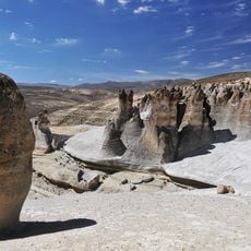
Cuevas de Sumbay
31.6 km
Jello Jello
46.8 km
Huarancante
48.1 km
Yuraq Urqu (Arequipa-Moquegua)
37.8 km
Suri Wasi
38.8 km
Kunturi (Tarucani)
42.1 km
Waqullani
46.6 km
Pukasaya (Arequipa)
48 km
Chunkara (Puno)
43.6 km
Kuntur Puñuna
42.7 km
Kuntur Sayana
48.1 km
Mollepunco
47.8 km
Molje Punco Cave
47.8 km
Represa El Fraile
34.3 km
Catarata de Pillones - Pauza
10.5 km
Scenic viewpoint
33.1 km
Mirador de flamencos
30.3 km
La Calera
38.8 km
Crucero alto
32.3 km
Montana Window
40.4 km
Scenic viewpoint
34.1 km
Panorama del Montana de Window
40 km
Scenic viewpoint
37.8 km
Scenic viewpoint
33 km
Catarata de Pillones
10.5 km
Catarata de Pillones - Pauza
10.4 km
Catarata de Pillones
13.4 kmReviews
Visited this place? Tap the stars to rate it and share your experience / photos with the community! Try now! You can cancel it anytime.
Discover hidden gems everywhere you go!
From secret cafés to breathtaking viewpoints, skip the crowded tourist spots and find places that match your style. Our app makes it easy with voice search, smart filtering, route optimization, and insider tips from travelers worldwide. Download now for the complete mobile experience.

A unique approach to discovering new places❞
— Le Figaro
All the places worth exploring❞
— France Info
A tailor-made excursion in just a few clicks❞
— 20 Minutes