
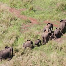
Garamba National Park
38 km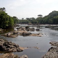
Okapi Wildlife Reserve
212.7 km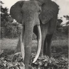
Gangala-na-Bodio Elephant Domestication Center
28.7 km
Domaine de chasse de Maika-Penge
154.3 km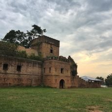
Dungu Castle
92.8 km
Mundu
134 km
Province of West Equatoria
224.6 km
Aga Falls
137.8 km
Loka Forest Reserve
182.8 km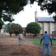
Christ the King Cathedral, Yei
150.5 km
Fajelu
113.2 km
Morokodo
231.4 km
Scenic viewpoint
103.3 km
Jalasika Left Turn - While Coming From AMEE
225.5 km
Garamba national park
94.8 km
JELASIKA Left Turn - While Coming From NGOTE
222.5 km
AMEE Left Turn - While Coming From MAHAGI
225.5 km
Bad Road Condition
200.2 km
APC Ditch - Take Care
188.3 km
Work of art, statue
155.1 km
BAZAR
180.8 km
GULU Village Burnt Houses
193.4 km
Dense Pine Forrest
207.6 km
Lone House Over Hill beside River
205.3 km
Houses inside TEDHI
204.1 km
Deep TEDHI Forest
200.9 km
Scenic viewpoint
153.6 km
Point G village 6 Zone 1 lmvepi
217.8 kmReviews
Visited this place? Tap the stars to rate it and share your experience / photos with the community! Try now! You can cancel it anytime.
Discover hidden gems everywhere you go!
From secret cafés to breathtaking viewpoints, skip the crowded tourist spots and find places that match your style. Our app makes it easy with voice search, smart filtering, route optimization, and insider tips from travelers worldwide. Download now for the complete mobile experience.

A unique approach to discovering new places❞
— Le Figaro
All the places worth exploring❞
— France Info
A tailor-made excursion in just a few clicks❞
— 20 Minutes